ATSC 113 Weather for Sailing, Flying & Snow Sports
Clouds > Stratiform Clouds
Learning Goal 1a. Identify & classify clouds, and relate them to local and larger-scale weather systems.
Layer clouds or stratiform clouds (St) look like sheets or blankets. They range from only 100 m to 6 km thick in the vertical, but can have a horizontal extent of 100 km to 1000 km. They are associated with layers in the atmosphere with different relative temperatures, as explained next.
The sketch below shows a wedge of cool or cold air at ground level. When a horizontal wind moves warmer air toward this cold wedge, the warm air slides up along the top surface of the cold air, because the warm air is more buoyant (lighter) than the cold air. This behavior is typical of warm fronts.
As the warm air rises, it gradually cools to the point where water vapour can condense and make clouds. Indeed, we often find stratiform clouds along warm fronts.
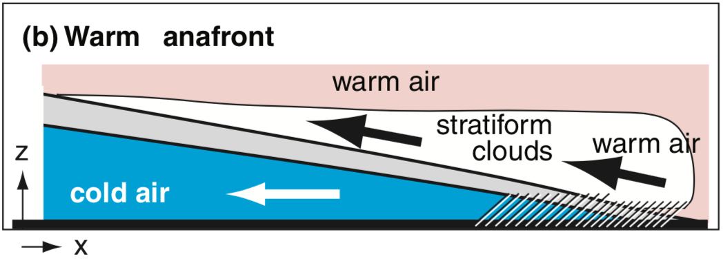
Vertical slice through a warm front, where warm air is advancing and cold air is retreating. z= height above ground (spanning 10 km in this example), x = horizontal distance (spanning 1000 km in this example). Slanted lines represent light rain.
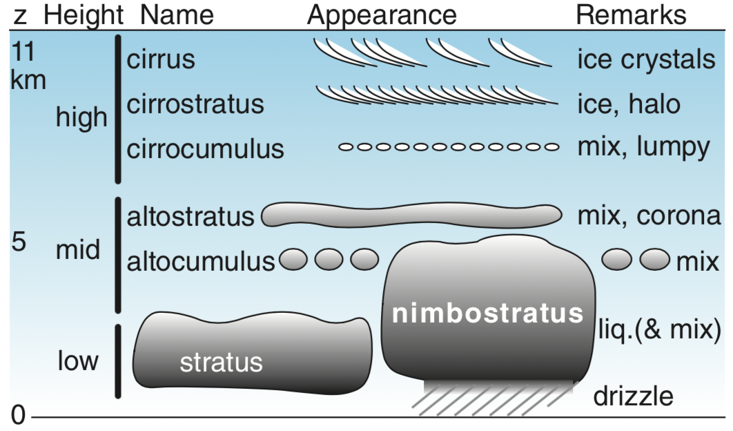
Stratiform clouds are classified by their altitude, and are grouped into 3 categories:
- High: cirrus (Ci), cirrostratus (Cs), and cirrocumulus (Cc)
- Middle: altostratus (As) and altocumulus (Ac)
- Low: stratus (St), and nimbostratus (Ns)
NOTE: Even though some of these stratiform cloud names have the word "cumulus" in them, these are still stratiform clouds. But for these cases, the layer of cloud will be lumpy (sort of like a blanket with holes in it).
The sketch below shows how stratiform clouds are classified by their altitudes (where z = height above ground):
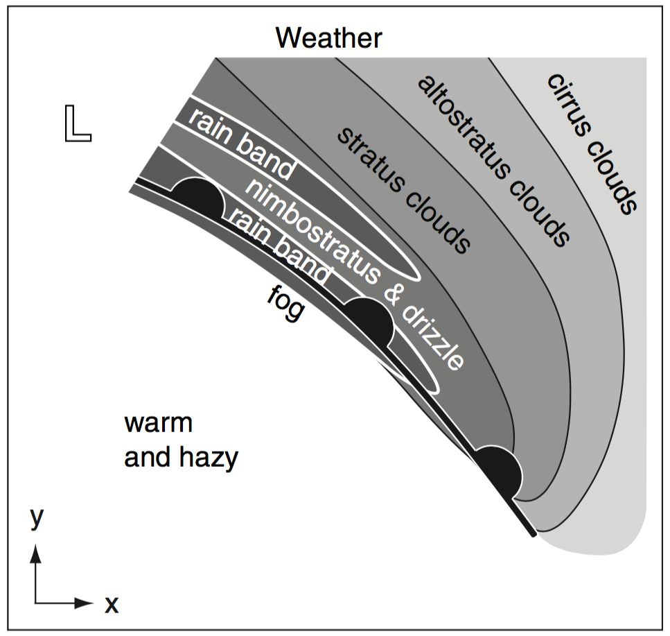
As a warm front approaches you, you normally see the high clouds first. These clouds extend many hundreds of kilometers ahead of the front, so you see them about half a day before the warm front arrives. Next comes the mid-level clouds, and finally the low clouds along with drizzle or light rain/snow. This sequence is sketched below, where the warm front (at the thick black line with semicircles) is moving toward the northeast (towards the upper-right corner), with the stratiform clouds ahead of the front.
Here are some photos showing examples of stratiform clouds.
Stratiform Clouds |
|
|
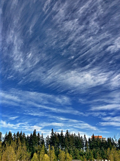
| 1. High.
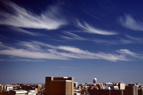
Cirrus
(rooftop video1 and video2) |
|
|
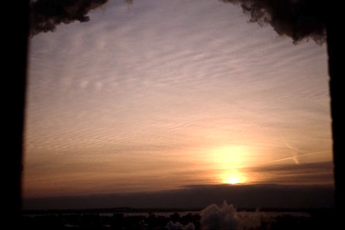
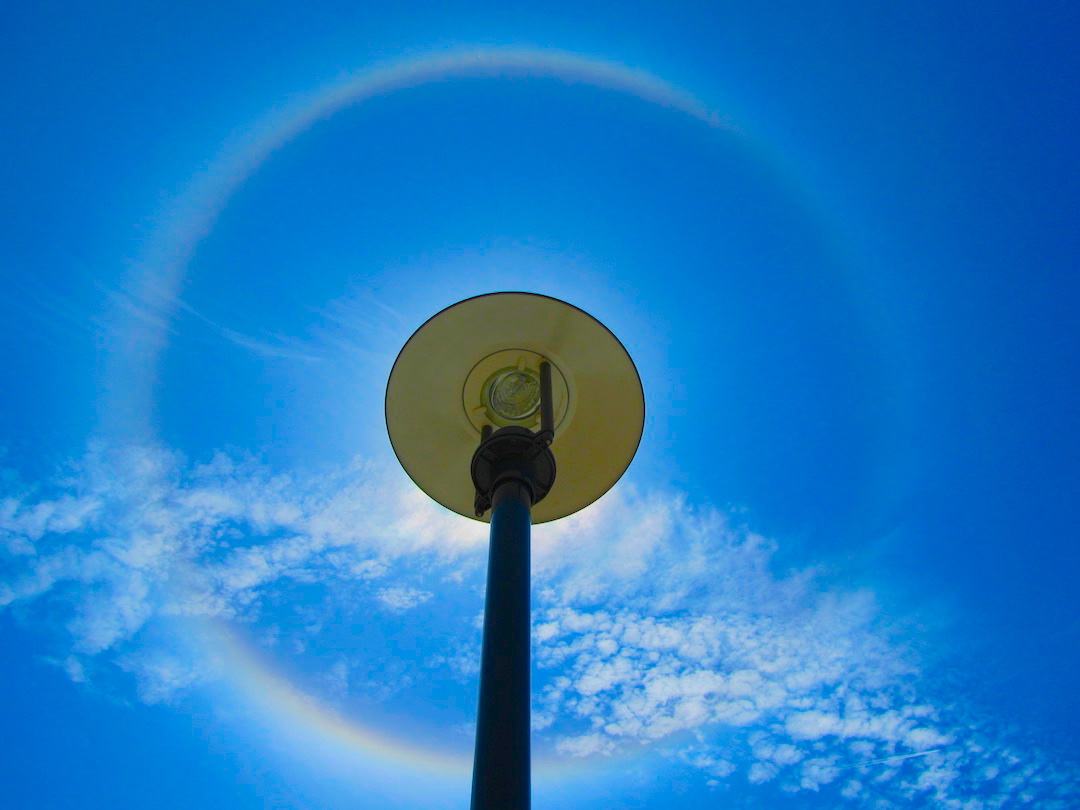
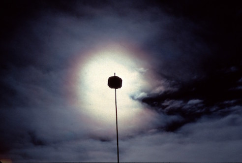
| 1. High.
Cirrostratus For photo at right, ignore the lumpy clouds. The halo is caused by a very thin cirrostratus cloud covering the whole sky. Ice crystals in this cloud act like prisms to bend the light, making the halo. The sun is hidden behind the light post. |
 |
 |
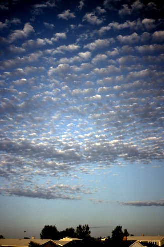
| 1. High.
Cirrocumulus
|
 |
 |
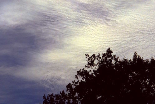
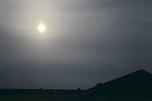
| 2. Middle.
Altostratus Left photo:The sun appears as a fuzzy spot of light through these clouds. Right photo: Water droplets in this cloud diffract the sun light to make the bright circle with colored fringes - called corona. |
|
 |
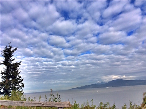
| 2. Middle.
Altocumulus
|
|
 |
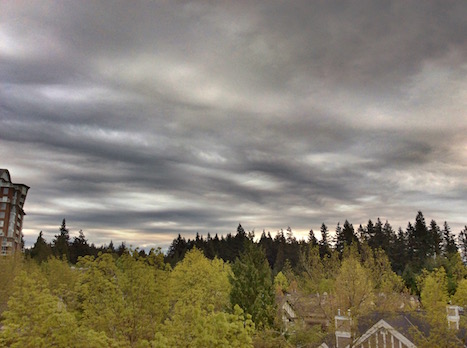
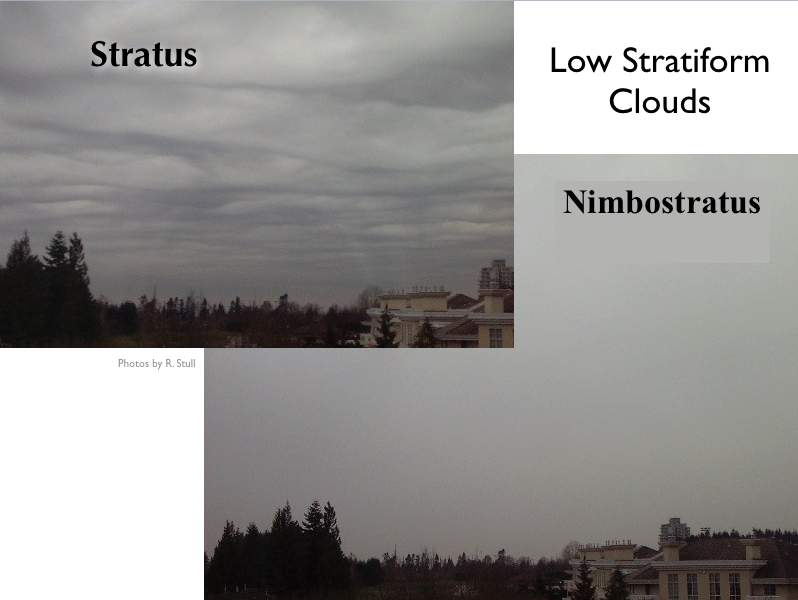
| 3. Low.
Stratus
|
|
 |
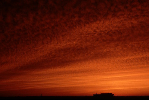
| 3. Low.
Nimbostratus
|
 |
 |
Stratus vs. Nimbostratus
Stratus and nimbostratus clouds both have low cloud bases, and by eye appear equally dark. But nimbostratus clouds are precipitating (snow, mist, drizzle, or light rain), while stratus is not. Thus, nimbostratus clouds often have diffuse (washed out) cloud bases, while stratus clouds often have well defined cloud bases. The next picture shows stratus and nimbostratus clouds photographed from the same vantage point on the same day.
Hazards
Stratiform clouds are not usually turbulent, so flying through them is often a smooth ride. However, inside any cloud, including stratiform clouds, pilots need to be flying on instruments because they cannot see the ground or landmarks (instrument flight is covered in Learning Goal 1g).
If the stratiform clouds are cold enough (at temperatures just below freezing), ice can form on the leading edges of the aircraft due to the quick freezing of supercooled (below freezing) liquid water drops (aircraft icing is covered in Learning Goal 3g). Also, soarplane pilots usually don't like stratiform clouds because they shade the ground and prevent thermal updrafts from forming.
Key words: altocumulus, altostratus, cirrocumulus,
cirrostratus, cirrus, corona, layer cloud, nimbostratus, stratiform
cloud, stratus, warm front
Extra info for experts; Not Needed for this Course.
Use this expert_resources link to find all the items listed below:
- Item - Topic
- World.A.1. - World Meteorological Organization (WMO) "International Cloud Atlas"
- USA.B.1. - Wikipedia list of cloud types
- World.A.2. - WMO: Manual on Cloud Observations (an old, outdated document)
- USA.A.1. - American Meteorological Society (AMS): Glossary of Meteorology
- USA.C.1. - Practical Meteorology (PrMet): Chapter 6, Clouds
Image credits. All figures by Roland Stull. Rooftop videos by the University of British Columbia.