ATSC 113 Weather for Sailing, Flying & Snow Sports
Special Clouds > Billow Clouds
Learning Goal 1b. Recognize special clouds (e.g. castellanus, billow, lenticular, rotor, banner, fractus, etc.)
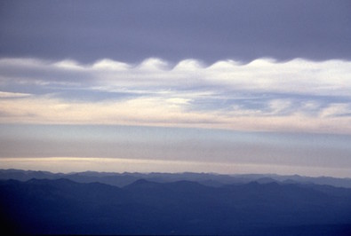
Wind shear (change of wind speed or direction with height) in the atmosphere can cause waves to form in a layer of air where cooler air underlies warmer air. These waves are called Kelvin-Helmholtz (KH) waves, and do not need mountains to form. These waves have relatively short wavelengths (crest to crest distance of hundreds of meters) and are relatively thin (hundreds of meters).
Such waves probably occur very often in the atmosphere, but are visible only rarely, when the rising cool air is relatively humid. Under the correct conditions, parallel bands of clouds form in the crest of each wave. To a viewer on the ground, these parallel bands of clouds look like billows of an accordion.
The waves often break, causing that cloud layer to become turbulent. While the waves are breaking, "cat's eye" swirls form, some of which are even visible on radar. Pilots prefer to avoid flying at these altitudes because of the turbulence induced by wind shear.
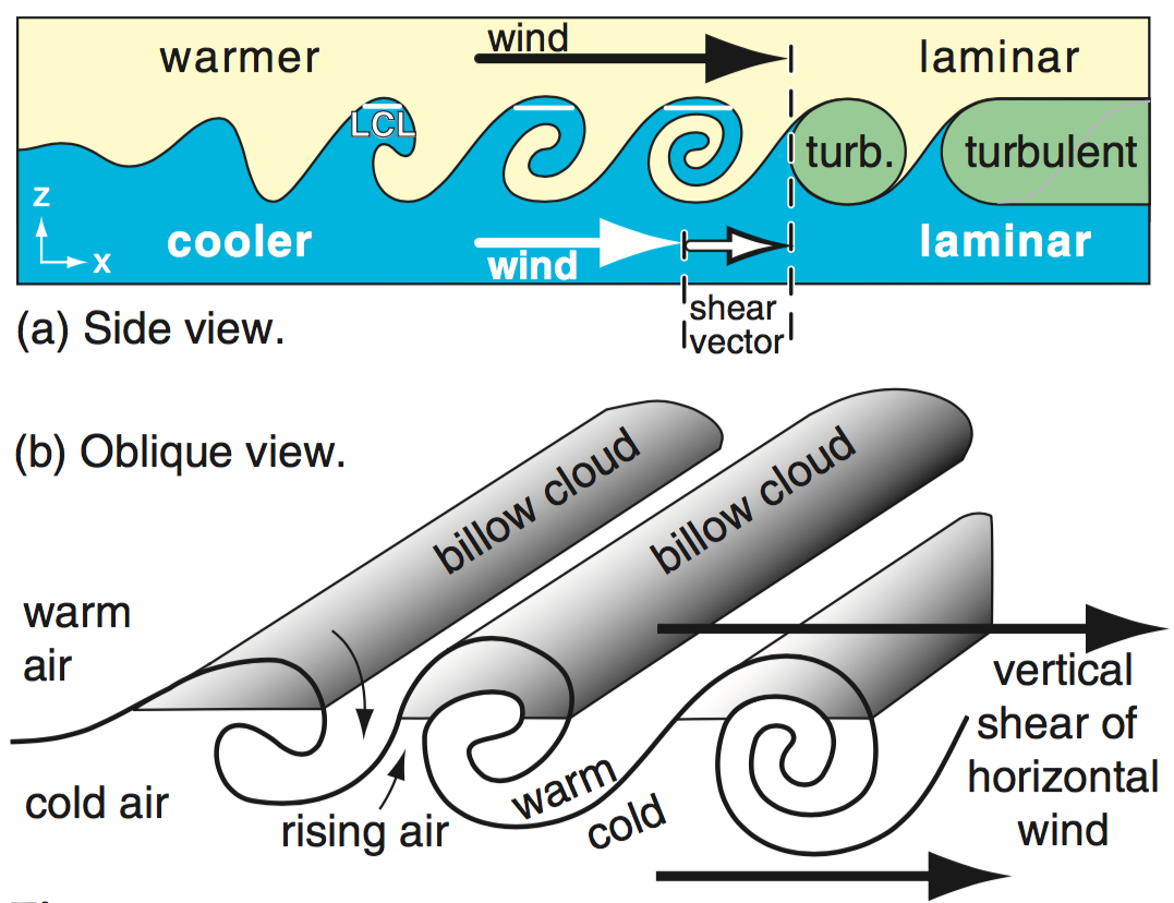
Because these waves happen in large horizontal regions, you can often see billow clouds as a high-cloud layer (cirrocumulus undulatus), or as mid-cloud layer (altocumulus undulatus). The photos below show some examples of billow clouds.
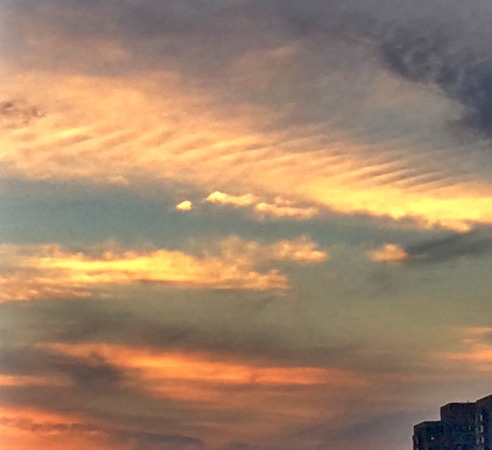
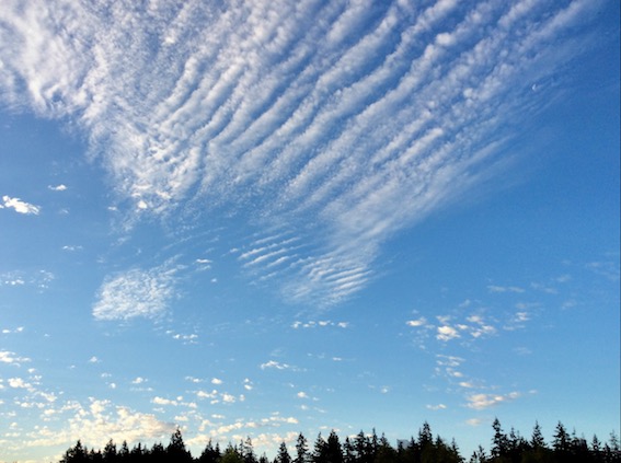
Here is a photo taken at sunset of high-altitude (cirrocumulus) billow clouds (in the top half of the photo):
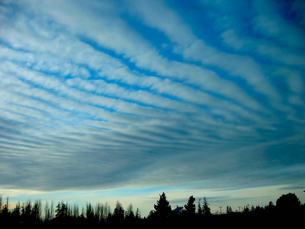
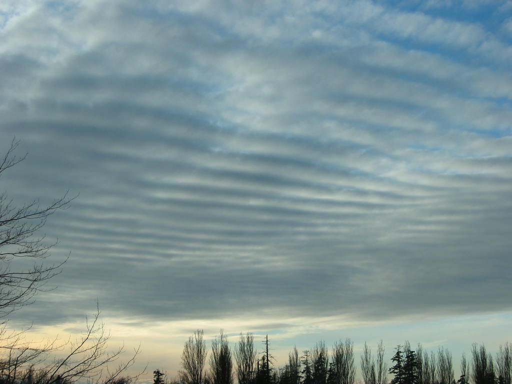
The next photos show mid-level (altocumulus) billow clouds:
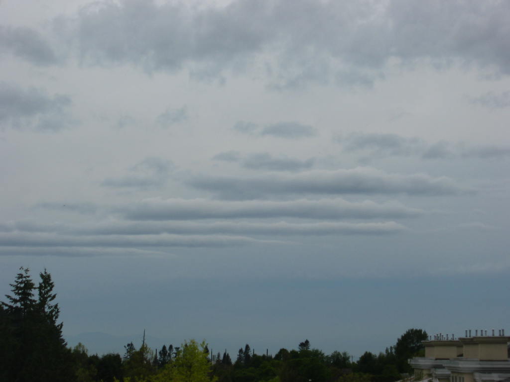
The next photo shows lower billow clouds under an overcast mid-level cloud layer.
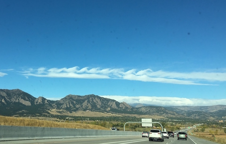
Next is a photo of breaking KH wave clouds, taken by Dr. May Wong (used with permission) at Boulder, Colorado in October 2016.
Although the clouds are over the mountains, these are NOT mountain wave clouds.
Instead these clouds are caused by wind shear at the altitude of the cloud.
If an aircraft were to fly at the altitude of this KH cloud, it would likely experience very strong turbulence.
Here is a local metro-Vancouver photo of breaking KH wave clouds, taken in June 2025 in Surrey, BC by Dr. Tim Chui (used with permission).
And here is a photo showing breaking KH waves on the side of a cumulus cloud:
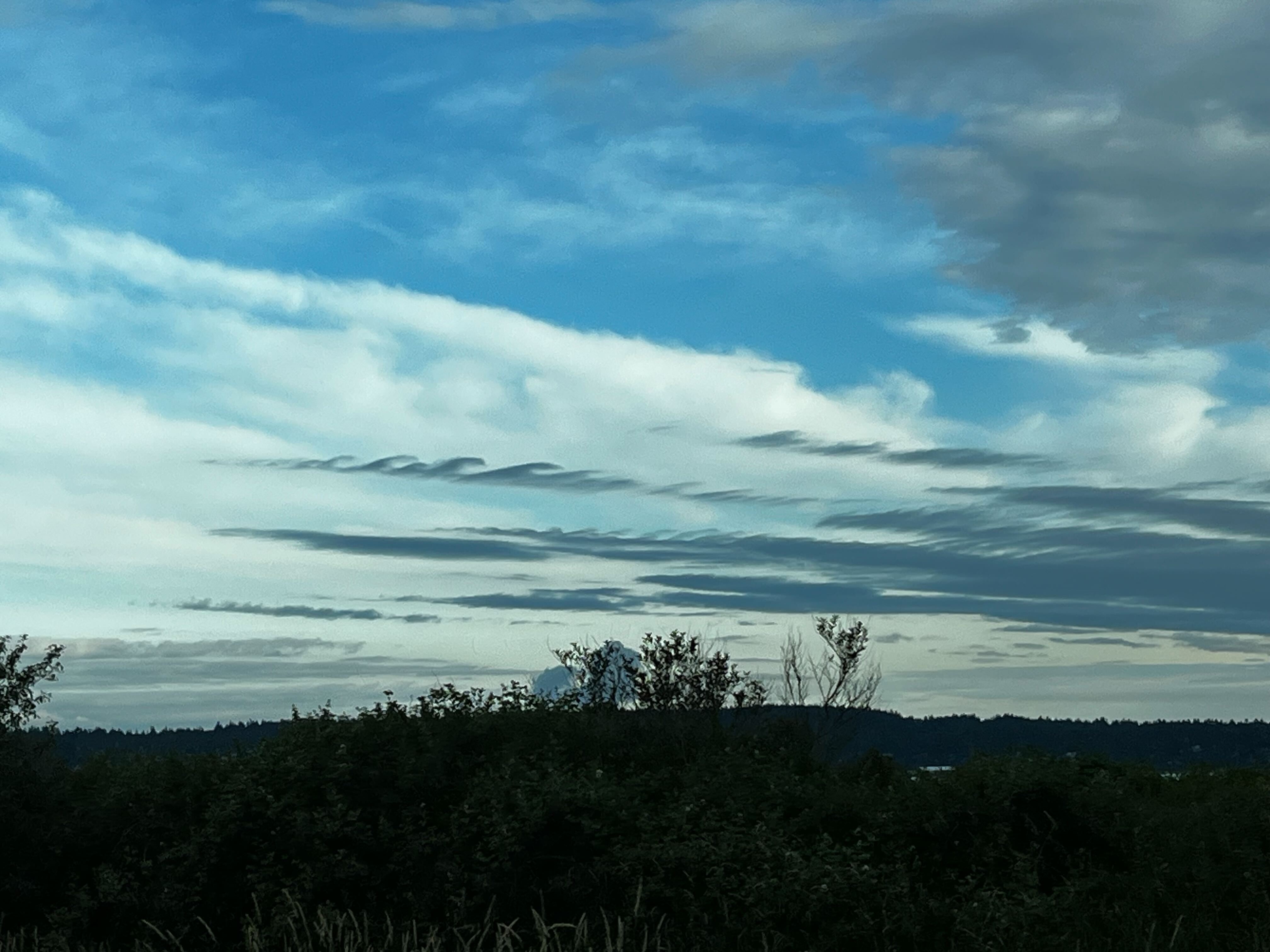
Below is a photo of a thin top layer of clouds with breaking KH waves.
You can also find many beautiful photos by web searching on images for "billow clouds" and for "kelvin helmholtz clouds".
Here are YouTube videos showing KH wave formation in a laboratory water tank, and in a computer simulation:
Here are YouTube videos of KH waves and billow clouds:
Key words: altocumulus undulatus, banner clouds, cirrocumulus undulatus, Kelvin-Helmholtz (KH) waves, wind shear
Extra info for experts; Not Needed for this Course.
Use this expert_resources link to find all the items listed below:
- Item - Topic
- World.A.1. - World Meteorological Organization (WMO) "International Cloud Atlas"
- USA.B.1. - Wikipedia list of cloud types, then search on "undulatus clouds", the official name for billow clouds.
- USA.A.1. - American Meteorological Society (AMS): Glossary of Meteorology
- USA.C.1. - Practical Meteorology (PrMet): Chapter 5 Stability, and Chapter 6 Clouds
Image credits. All figures and photos by Roland
Stull, except as noted near the figures. Two KH wave photos
by Dr. May Wong, used with permission.