ATSC 113 Weather for Sailing, Flying & Snow Sports
Special Clouds > Pileus Clouds
Learning Goal 1b. Recognize special clouds (e.g. castellanus, billow, lenticular, rotor, banner, fractus, etc.)
Pileus is a scarf cloud that forms above a rapidly rising cumulus cloud such as a cumulus congestus cloud. It is very short lived (minutes).
NOTE: The pileus cloud is not a thunderstorm anvil cloud.
When a cumulus congestus cloud rises through the ambient environment, it pushes the environmental air out of the way. Some of this air is pushed off to the sides of the rising cumulus; some, just above the top of the cumulus, are pushed upward, just ahead of the rising cumulus top. If this environmental air has thin layers of humid and dry air, then when this sandwich of air is pushed upward, the humid air layers can make a thin cloud layer — the pileus cloud.
But very quickly the rising top of the cumulus congestus cloud pushes up through the pileus cloud, causing the pileus to disappear.
Here is a sequence of photos showing the evolution of a thin, curved pileus cloud forming just above the top of the tallest cumulus congestus cloud. The photos were taken at roughly 30 second intervals.
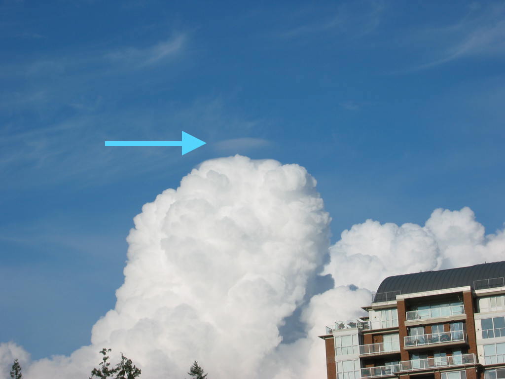
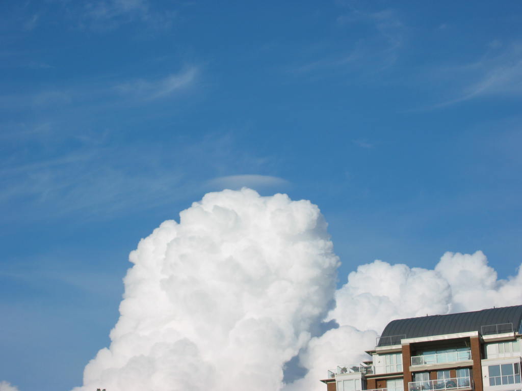
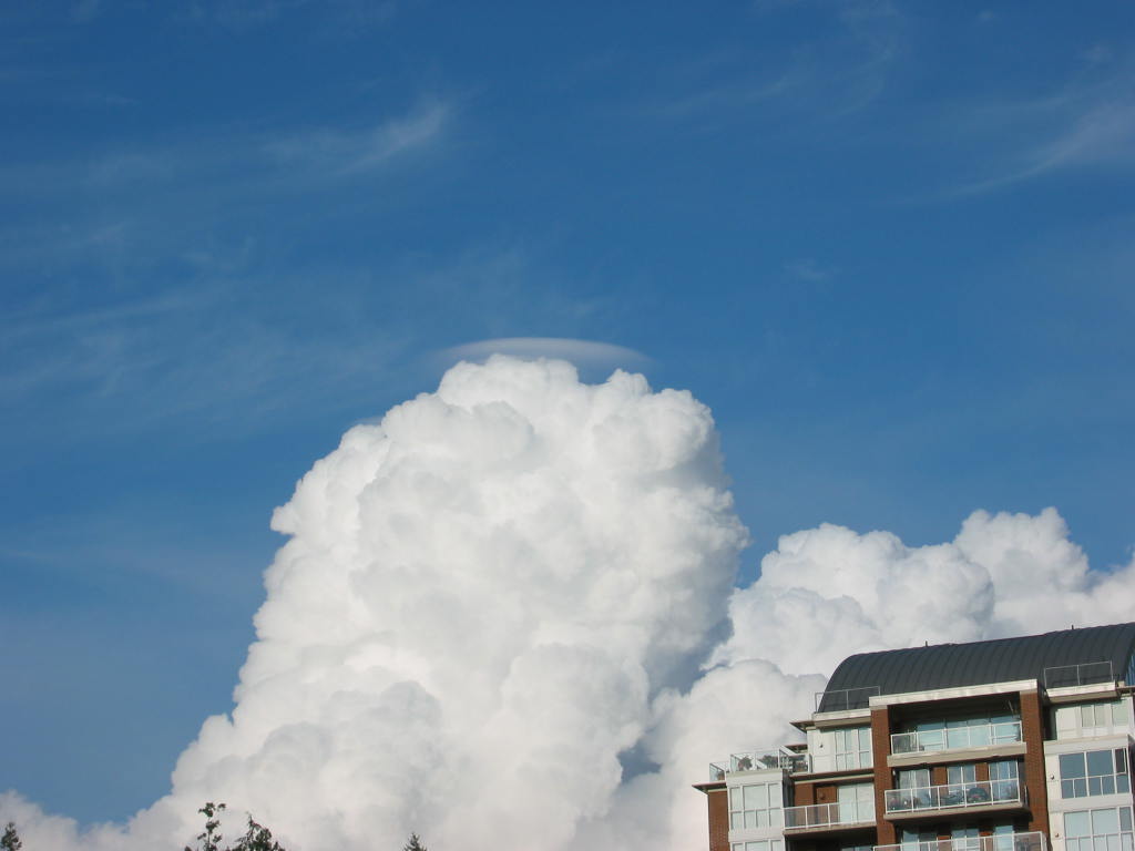
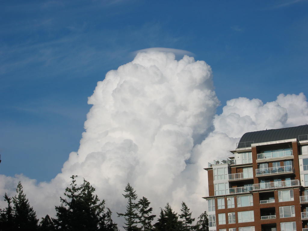
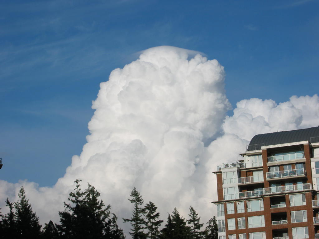
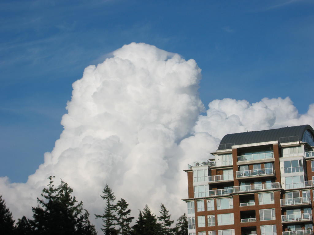
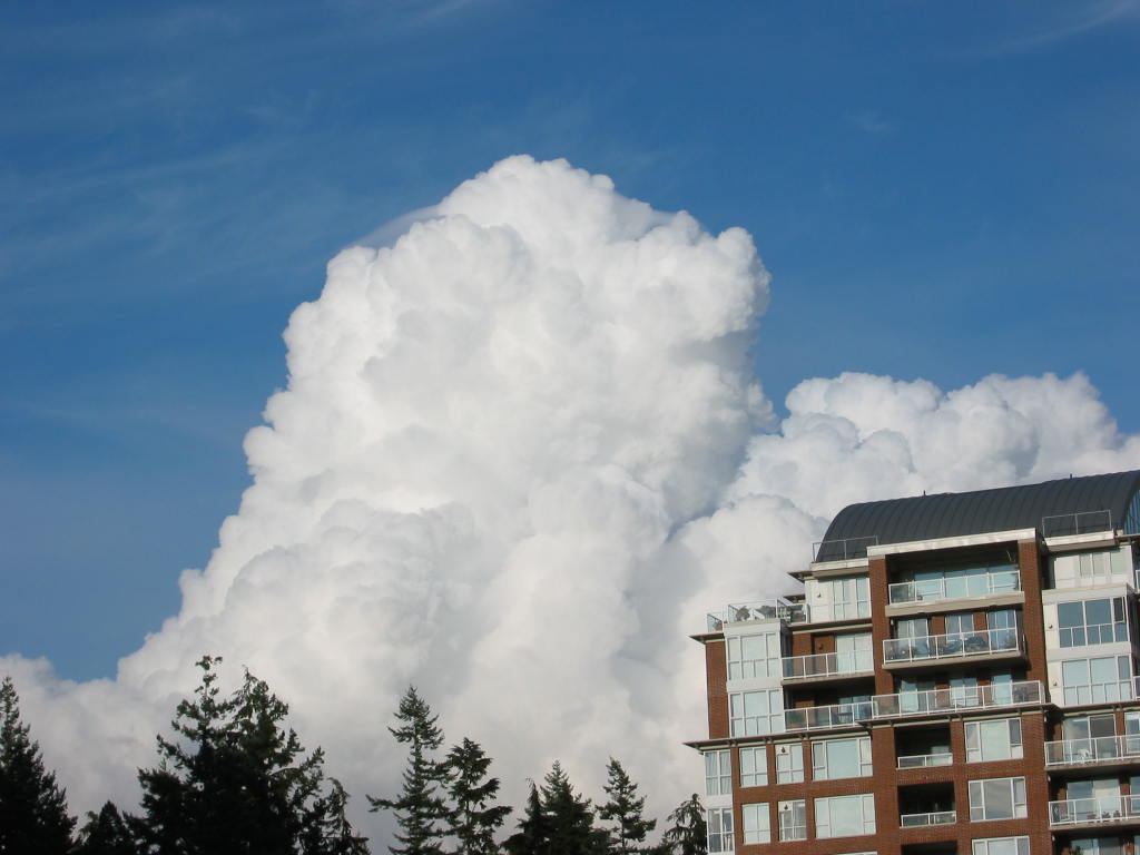
Although pileus are interesting, their existence does not tell you anything useful that can help your flying, sailing, or snowboarding. However, the cumulus congestus cloud implies strong updrafts and turbulence, and can possibly grow into a thunderstorm later.
For more photos of pileus, do a web search on images of "pileus clouds".
Keywords: cumulus congestus, pileus clouds
Extra info for experts; Not Needed for this Course.
Use this expert_resources link to find all the items listed below:
- Item - Topic
- World.A.1. - World Meteorological Organization (WMO) "International Cloud Atlas"
- USA.B.1. - Wikipedia list of cloud types
- World.A.2. - WMO: Manual on Cloud Observations (an old, outdated document)
- USA.A.1. - American Meteorological Society (AMS): Glossary of Meteorology
- USA.C.1. - Practical Meteorology (PrMet): Chapter 6, Clouds
Image credits. All figures copyright by Roland Stull.