ATSC 113 Weather for Sailing, Flying & Snow Sports
Special Clouds > Rotor Clouds
Learning Goal 1b. Recognize special clouds (e.g. castellanus, billow, lenticular, rotor, banner, fractus, etc.)
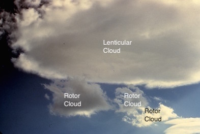
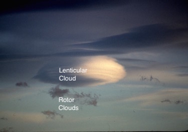
Rotor clouds are turbulent,
ragged-looking clouds that form at low altitude under the crests of
mountain waves. They rotate about a horizontal axis parallel to the
mountain range. They are associated with violent turbulence that can
break wings off of aircraft, and their strong up- and down-drafts can
cause pilots of small aircraft to crash while attempting to land and
take off.
Diagram 1. The average wind is blowing from left to right, across the mountain rainge. The wavy black lines represent the movement of air as it blows downwind as a mountain wave. But notice that on the bottom side of the rotor, the air is blowing in the opposite direction to the average wind direction at higher altitude. In these examples, the middle and high-altitude winds are from the west (from the left side of the diagram), while the bottom of the rotor has winds from the east. This change in wind direction over relatively short horizontal and vertical distances makes flying extremely difficult and dangerous.
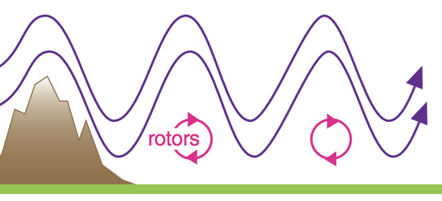
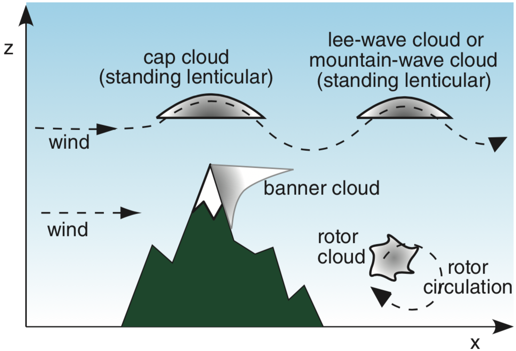
Diagram 2. If the air is humid enough, then clouds can form in the updraft portions of the wave and rotor circulations. Lenticular clouds can form in the top part of the mountain waves, and rotor clouds can form in the updraft portion of the rotor circulation. If the air is flowing over a long mountain range instead of an isolated peak, then the rotor cloud can be a long horizontal rough-looking turbulent cylinder parallel to the ground (the diagram above shows only one end of the cylinder). Similarly, the lenticular clouds can be long bands above and parallel to the mountain range (the diagram above shows only the end of these lenticular cloud bands).
Here is a video simulation, showing a rotor circulations forming on the lee (downwind) side of a mountain range: https://www.youtube.com/watch?v=xOjrIbcKGpc
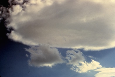
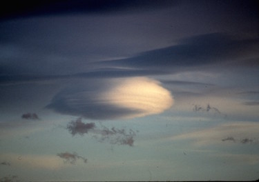
The next two photos show the ragged, turbulent rotor clouds under smoother-looking lenticular clouds.
Same photos with labels:
If the air is relatively dry, then neither lenticular clouds nor rotor clouds will form, even though dangerous mountain waves and rotors can still be present. In other words, if there are strong winds blowing across the mountains, then there can be dangerous mountain waves and rotors even if you cannot see any rotor or lenticular clouds.
Unfortunately, the few photos that I have with rotor clouds also have so many other clouds that you cannot distinguish the rotor clouds. Also, a word of caution: a Google image search on "rotor clouds" shows many images that are NOT really rotor clouds.
Here is a time-lapse video of rotor clouds in Boulder, Colorado: https://www.youtube.com/watch?v=Cy0_PZiagBw
The rotor cloud is visible rotating in the background.
The video camera is located at the "x" in Diagram 2 above, and the wind is blowing toward the video camera.
Keywords: mountain waves, rotor, rotor clouds, lenticular clouds
Extra info for experts; Not Needed for this Course.
Use this expert_resources link to find all the items listed below:
- Item - Topic
- World.A.1. - World Meteorological Organization (WMO) "International Cloud Atlas"
- USA.B.1. - Wikipedia list of cloud types
- World.A.2. - WMO: Manual on Cloud Observations (an old, outdated document)
- USA.A.1. - American Meteorological Society (AMS): Glossary of Meteorology
- USA.C.1. - Practical Meteorology (PrMet): Chapter 17, Regional Winds
Image credits. All figures by Roland Stull.