Types of Thunderstorms > Basic Storms
Learning Goal 4a (continuation):
Describe thunderstorm cells and the different
types of thunderstorms. (This portion is on basic thunderstorms.)
- Basic storm types:
a. single cell (airmass)
b. multicell
c. orographic
| BASIC STORMS | ||
|---|---|---|
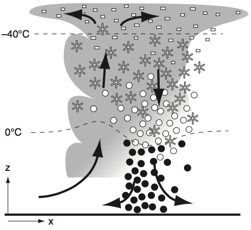
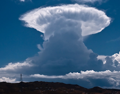
| a. Single-cell (airmass) Thunderstorm | ||
| These
are short-lived (15 to 30 minutes) and often not as violent as other types of thunderstorms. At right, in the vertical cross section: white dashes indicate ice crystals, asterisks indicate snow flakes, white dots are supercooled (unfrozen) liquid water raindrops, black dots indicate raindrops. Gray background indicates clouds. Arrows indicate winds. |
|
 |
| b. Multicell Thunderstorm | ||
|
Two or more cells.
Each cell can be in a different stage of its life
cycle. Below, in the vertical cross section:
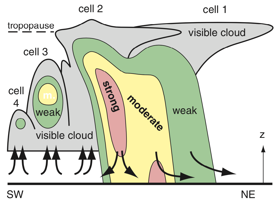 Light gray indicates clouds. Black arrows indicate up- and down-drafts. Colors indicate intensity of rain as might be seen on weather radar. Note that only the rain portions are visible on radar. |
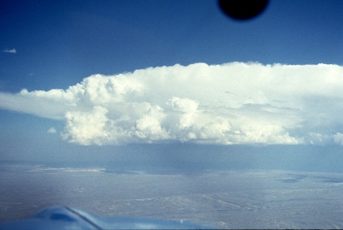 Multicell thunderstorm as viewed from the cockpit. |
|
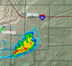 Horizontal (map) radar image. Red colors indicate the centers of the cells. The thin blue arc is a gust front. |
||
| c. Orographic Thunderstorm | ||
| These form over mountains. When the wind blows warm humid air toward hills and mountains, the air hits the mountain and is forced to rise. If it rises far enough, a cloud can form, and could develop into a thunderstorm if conditions are right. If an orographic storm is stationary, then all the rain falls in the same watershed, causing flash floods. | 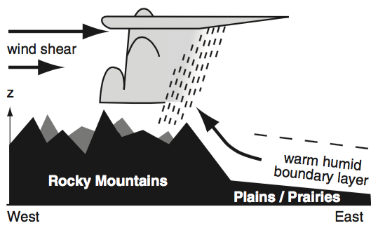 |
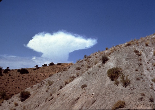 |
| A line of orographic thunderstorms over the Vancouver Island mountains, as viewed from UBC. Photo 24 March 2018 by Shawn Nigam, used with permission. |
 |
|
Key words: multicell thunderstorm, orographic thunderstorm, single-cell (airmass) thunderstorm
Extra info for experts; not needed for this course.
- Stull, 2017: Practical Meteorology. Chapter 14. Thunderstorm Fundamentals.
Image credits. All figures by Roland Stull, except
the following: Airmass thunderstorm photo, Single-cell
cumulonimbus
incus © User:sfortis / Wikimedia commons / CC
BY-SA 3.0. Radar images courtesy of the US National Weather Service.