Types of Thunderstorms > Mesoscale Convective Systems (MCS)
Learning Goal 4a (continuation) :
Describe thunderstorm cells and the different
types of thunderstorms. (This portion is on MCS's.)
- Mesoscale convective system (MCS) storm types:
d. squall line
e. bow echo
f. mesoscale convective complex (MCC)
g. mesoscale convective vortex (MCV)
| MESOSCALE CONVECTIVE SYSTEMS (MCS) | ||
|---|---|---|
| d. Squall-line Thunderstorm | ||
|
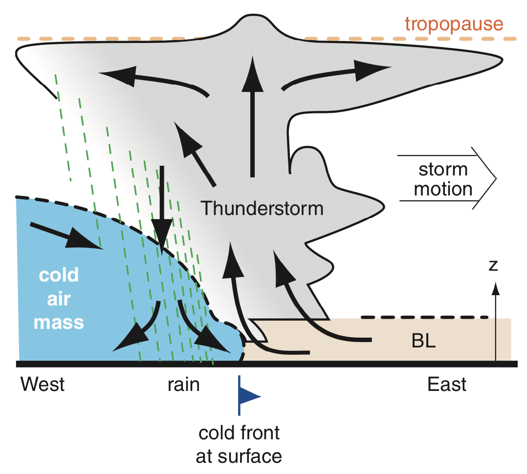
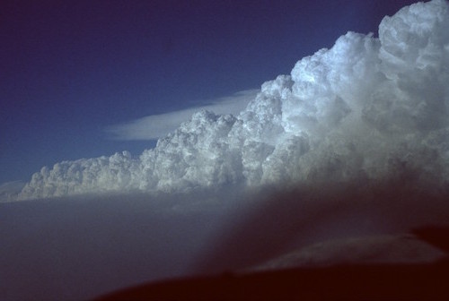
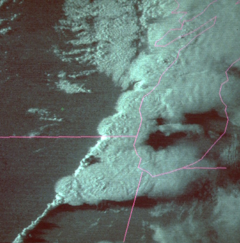
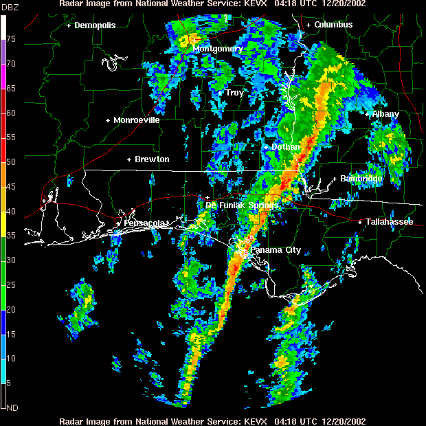
These are a wall of thunderstorms standing shoulder to shoulder, often along or ahead of a cold front (the leading edge of a relatively cold air mass). Top right. I took this picture while flying behind the squall line. The cold front is moving from left to right—I am flying in the cold air. Winds aloft are from the left, so the anvil clouds are blown to the right, where we cannot see them behind the wall of clouds. Top left. Vertical slice through the squall line. z is height above ground. Bottom left. Satellite image of a squall line from southwest to northeast, over Illinois and Wisconsin. Bottom right. Radar image of a squall line crossing Florida, where the line of heavy rain is shown with the red colors. |
 |
 |
 |
 |
|
| e. Bow-echo Thunderstorm | ||
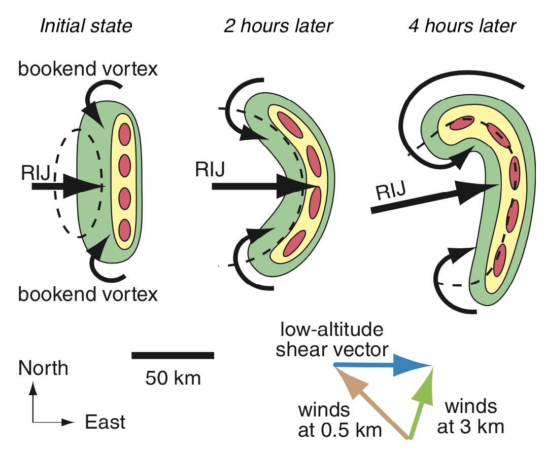 This horizontal-cross-section diagram shows the evolution of bow-echo thunderstorm formation. A line of thunderstorms (dark red ovals) is bent into an arc or bow shape by fast winds (black arrows) from behind, called the rear inflow jet (RIJ). In the diagram, the color progression green/yellow/red indicates progressively heavier rain as might be seen on weather radar. |
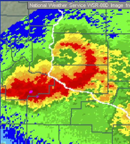 Radar image showing the bowed line of heavier rain cells as dark red. |
|
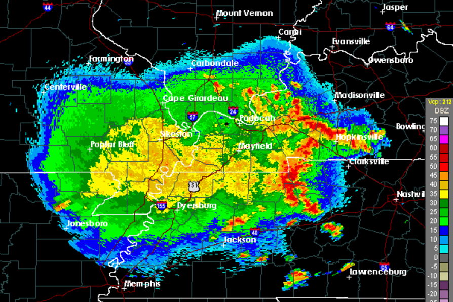
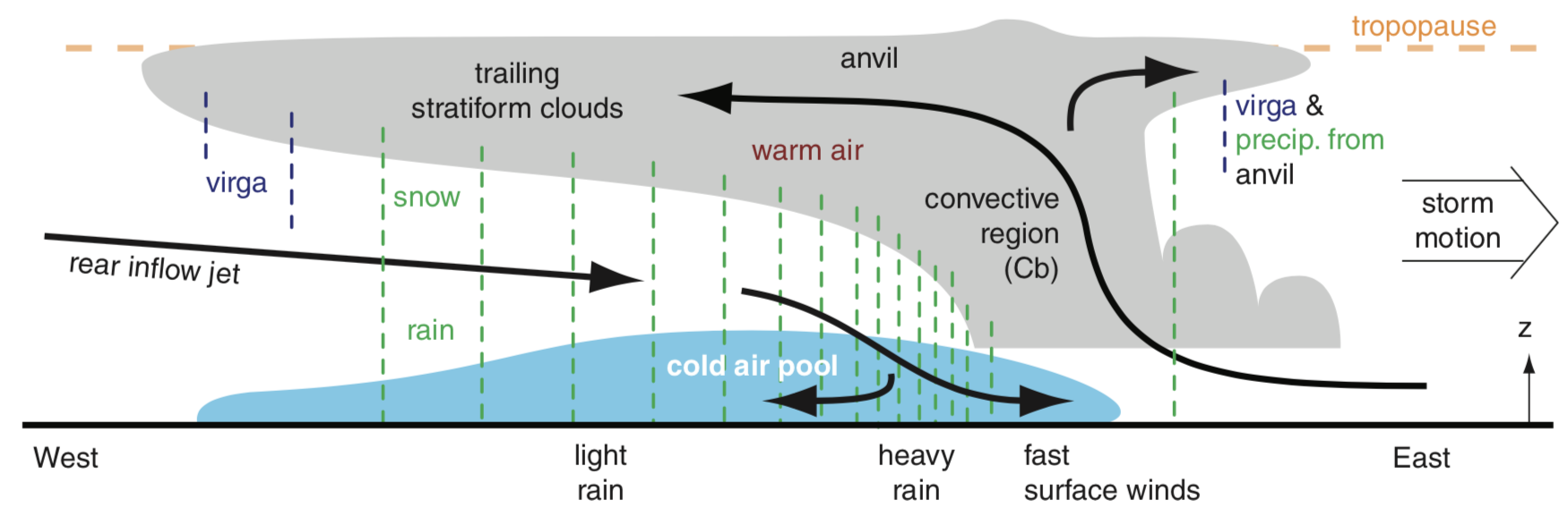
| f. Mesoscale Convective Complex (MCC) | ||
|
This is a line or region of strong thunderstorm cells with heavy rain,
followed by moderate and lighter rain extending over a broad region. Top. Radar map view of an MCC, where the strong thunderstorms are shown with red colors near the right side of the complex, while the moderate rain (orange and yellow areas) and lighter rain (green colors) extend over a broad region. This storm is moving from left to right (west to east). Bottom.Vertical slice through the center of the MCC, with clouds shown as light gray and winds as black arrows, and precipitation as dashed vertical lines. The light blue color indicates a pool of cold air that was created by evaporating rain from the MCC. Green dashed lines indicate precipitation. z is height above ground. Virga is precipitation that completely evaporates before reaching the ground, but which can affect flight. |
 |
|
 |
||
| g. Mesoscale Convective Vortex (MCV) | ||
| When MCCs dissipate late at night, often the remaining non-stormy clouds at middle altitudes (~5 km above ground) have a very slow rotation counterclockwise around where the center of the MCC was. This is not dangerous to flight, though the rotation can help trigger new MCCs the next day after the sun has added more heat to the bottom of the atmosphere. (Sorry, no photos.) | ||
Keywords: bow echo, mesoscale convective complex (MCC), mesoscale convective vortex (MCV), rear inflow jet (RIJ), squall line
Extra info for experts; not needed for this course.
- Stull, 2017: Practical Meteorology. Chapter 14. Thunderstorm Fundamentals.
Image credits. All figures by Roland Stull, except the radar and satellite images, which are courtesy of the US National Weather Service.