Types of Thunderstorms > Supercells
Learning Goal 4a (continuation):
Describe thunderstorm cells and the different
types of thunderstorms. (This portion is on supercells.)
- Supercell thunderstorm types:
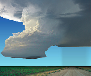
h. low precipitation (LP)
i. classic (CL)
j. high precipitation (HP)
Supercell thunderstorms are the most dangerous and longest lived. The updraft often appears as a slowly rotating cloud column. Such a rotating supercell is called a mesocyclone. Although mesocyclone rotation is too slow to see by eye, you can see its nature in time-lapse videos that speed up the displayed rotation. For the following videos, you can view them even faster via the Settings control (2x speed) in your YouTube player.
- A 2.5 minute time-lapse video of several mesocyclones. https://www.youtube.com/watch?v=LRrXugg2PBI
- A 3 minute time-lapse video of supercell mesocyclones. https://www.youtube.com/watch?v=Y4EK2r9JJ1k
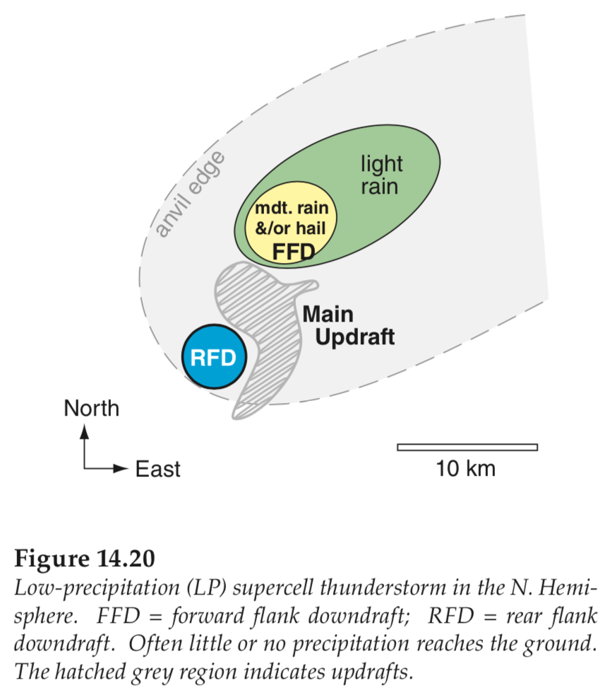
All the diagrams in the right column of the following table show
horizontal (map) views of the components of the storms, including
downdrafts, winds, rain, updrafts, and possibly tornadoes.
Terminology used in the figures below:
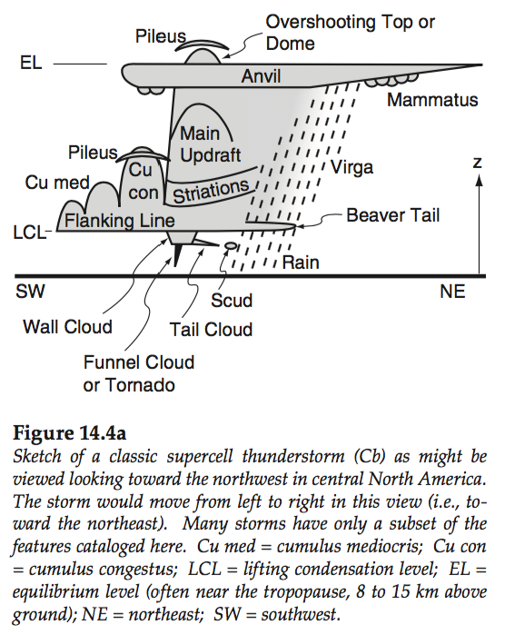
- cu con = cumulus congestus (= the cumulus stage of a thunderstorm, with strong updrafts.)
- cu med = cumulus mediocris (= medium size cloud, with moderate updrafts. Not yet a thunderstorm.)
- FFD = foreward-flank downdraft of air, near the front edge of the storm.
- RFD = rear-flank downdraft of air, near the back edge of the storm. In all the diagrams in the right column below, the whole storm is moving toward the northeast.
Updrafts and downdrafts of air are felt as violent turbulence by
aircraft flying through them (not recommended). Also, when when
downdrafts hit the ground, the air spreads out to create gust fronts
(see Learning Goal 4d).
| SUPERCELLS | ||
|---|---|---|
| Supercell types | Photo or vertical cross section | Map or horizontal cross section |
|
h. Low-precipitation (LP) Supercell Although LP storms do not have much rain, they can produce large hail and downburst winds. |
 |
 |
|
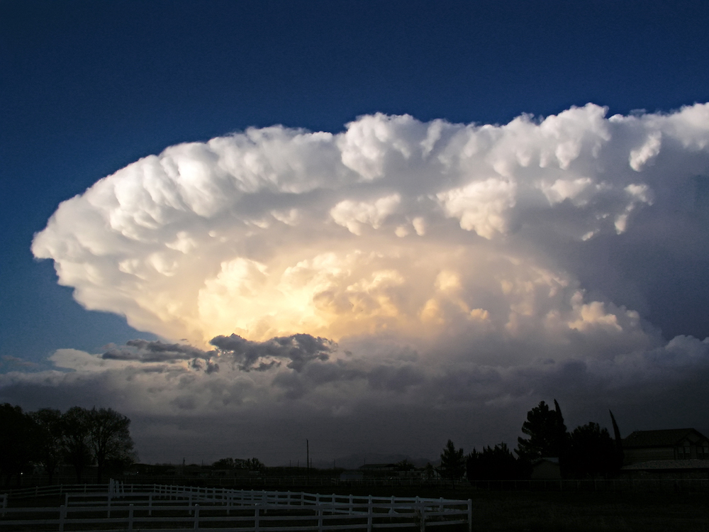
i. Classic Supercell Although only a small percentage of supercells spawn tornadoes, the supercell tornadoes are often the strongest. As the diagrams show, there is a complex interplay of winds and rain, making flight near all supercells extremely dangerous. Classic supercells can have a hook-echo shape on the radar reflectivity image as the rain area wraps around the low-pressure region of the storm, called a meso-low. Often the whole thunderstorm rotates very slowly as a mesocyclone (a cyclonically rotating vortex, around 2-10 km in diameter, in a convective storm). |
  |
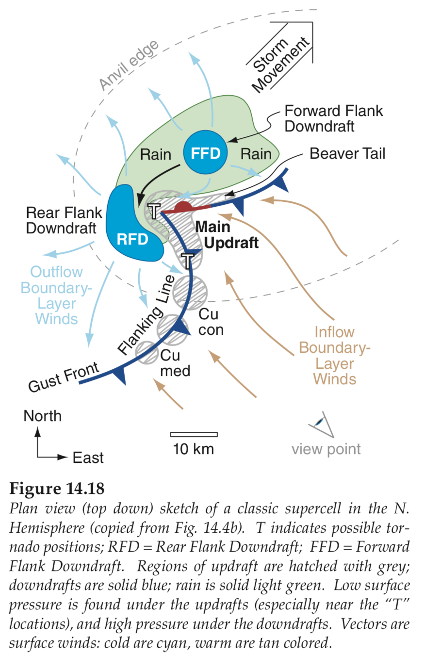 |
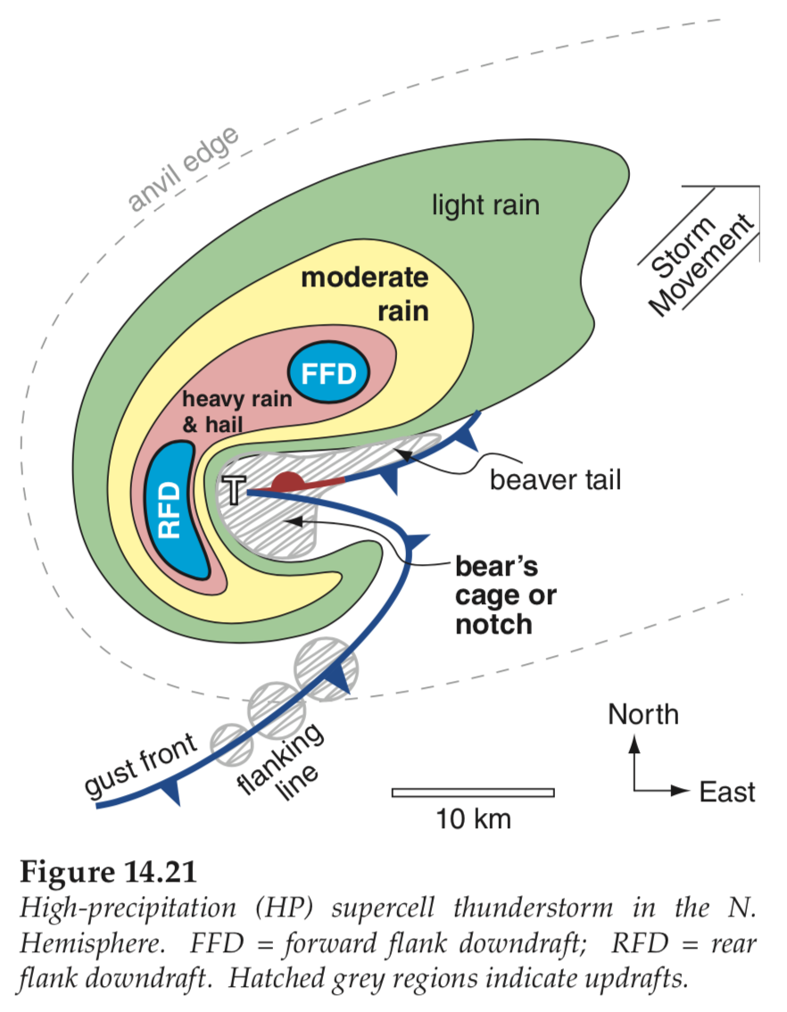
| j.
High-precipitation (HP)
Supercell As the name suggests, the rain area is often much more extensive, and wrapped almost completely around the center of rotation of the mesocyclone. These rain curtains can hide the dangerous tornado. |
 |
 |
Videos
Here are some excellent YouTube videos showing the different types of supercell thunderstorms. Many of these are time-lapse movies that are speeded up in the playback. This allows you to see the (usually counter-clockwise) mesocyclone rotation of the whole thunderstorm, which is normally too slow to discern by eye.
Low Precipitation Supercells
- LP in 2020 . https://www.youtube.com/watch?v=h8iNtbgltlI
- LP in 2012 (5 min, play fast). https://www.youtube.com/watch?v=2HBP9TNl-Io
Classic Supercells
- Classic at Brisbane, Australia. Nov 2013. https://www.youtube.com/watch?v=o1eP5WVM5bQ
(Note: Since Australia is in the Southern Hemisphere, the mesocyclone rotates clockwise.) - Classic at Booker, TX. 3 June 2013. https://www.youtube.com/watch?v=ZUFGx68gyLk&t=1s
High Precipitation Supercells
- HP in NSW, Australia. 17 October 2022. https://www.youtube.com/watch?v=tc-1g8k2QF4
- HP in Texas. 2015. https://www.youtube.com/watch?v=trVMTXoDPGA
Keywords: classic (CL) supercell, low-precipitation
(LP) supercell, high-precipitation (HP) supercell, meso-low,
mesocyclone, tornadoes
Extra info for experts; not needed for this course.
- Stull, 2017: Practical Meteorology. Chapter 14. Thunderstorm Fundamentals.
Image credits. All figures by Roland Stull, except
the following: Classic supercell photo Chaparral Supercell courtesy of Greg Lundeen of
the US National Weather Service (NWS). LP Supercell
courtesy of the US NWS. HP supercell courtesy of the US NWS.