w11-Weather
Because of the length of this trip and the distance covered, it is difficult to provide an accurate weather forecast. It is also highly dependent on the route you choose to take. The weather will be very different if you end up crossing a high pressure system than if you end up circling a low pressure system. What’s most important is the strength and direction of the winds.
The following images are for 5am on July 25, 2016 (your expected date of departure).
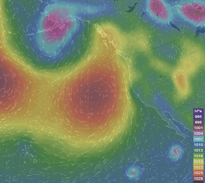
Caption: This image maps air pressure in hPa and was sourced from windytv.
Interpretation
This image shows areas of higher pressure in oranges and reds, and areas of lower pressure in blues and purples. The streaks are wind forecasts. Note that there are two high pressure centres, one in the middle of the image off the west coast of the US and the other is on the left side of the image at the end of the Aleutian Islands. There is a low pressure system over Alaska, US, and somewhere over the central Candian provinces. Note the Hawaiian Islands are in the bottom left corner.
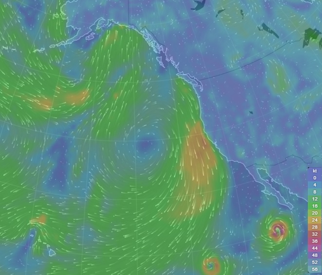
Caption: This image maps wind speeds in kt and direction and was sourced from windytv.
Interpretation
This image shows the wind speeds and general wind direction with higher speeds in oranges and reds and lower speeds in light to dark blues. There are strong northerly winds coming down the California coast progressing into moderate winds across the Pacific towards Hawaii. Note the absence of wind at the centre of the high pressure systems.