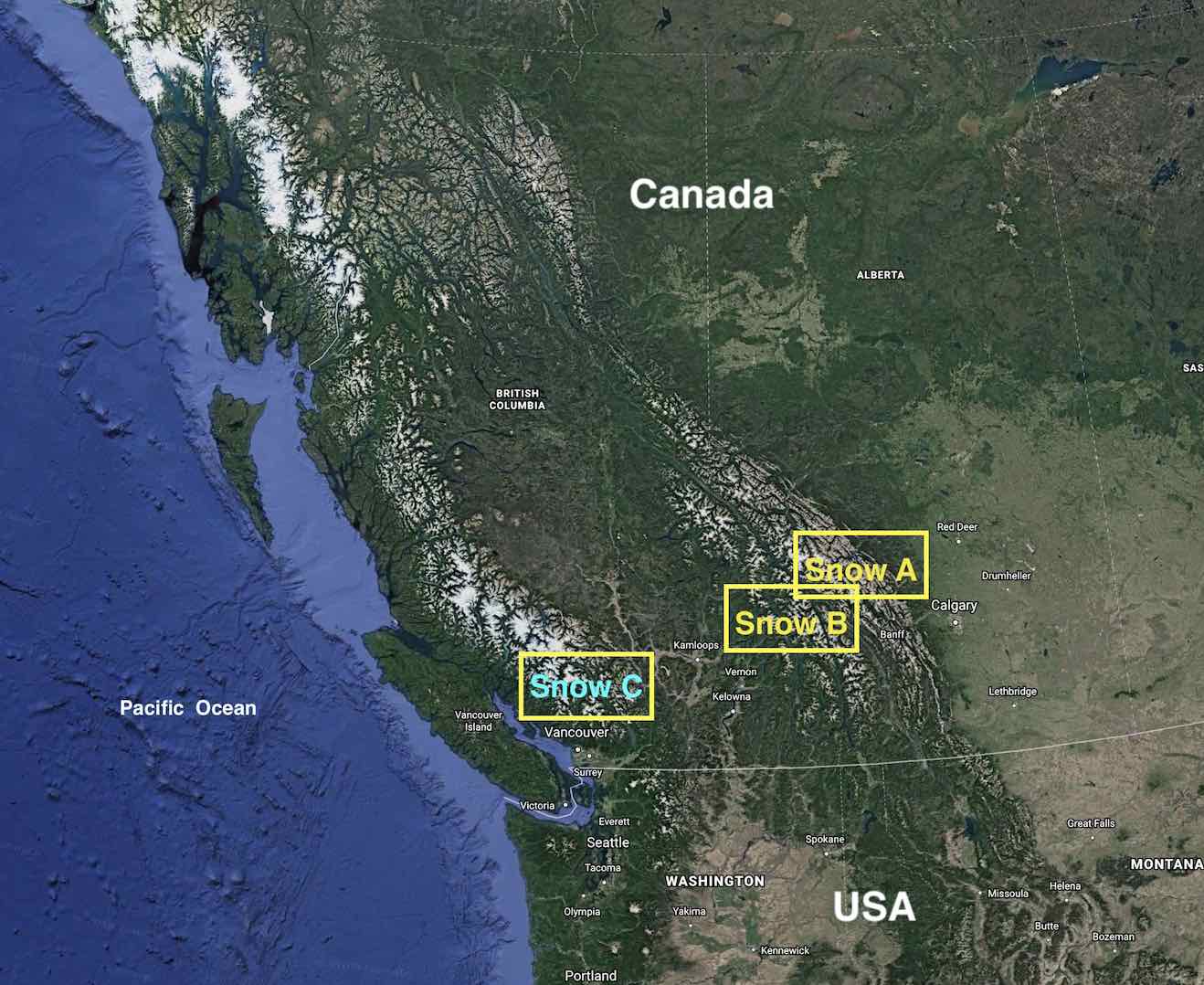
Snow B - Maps
The big picture
Saphire Col Route
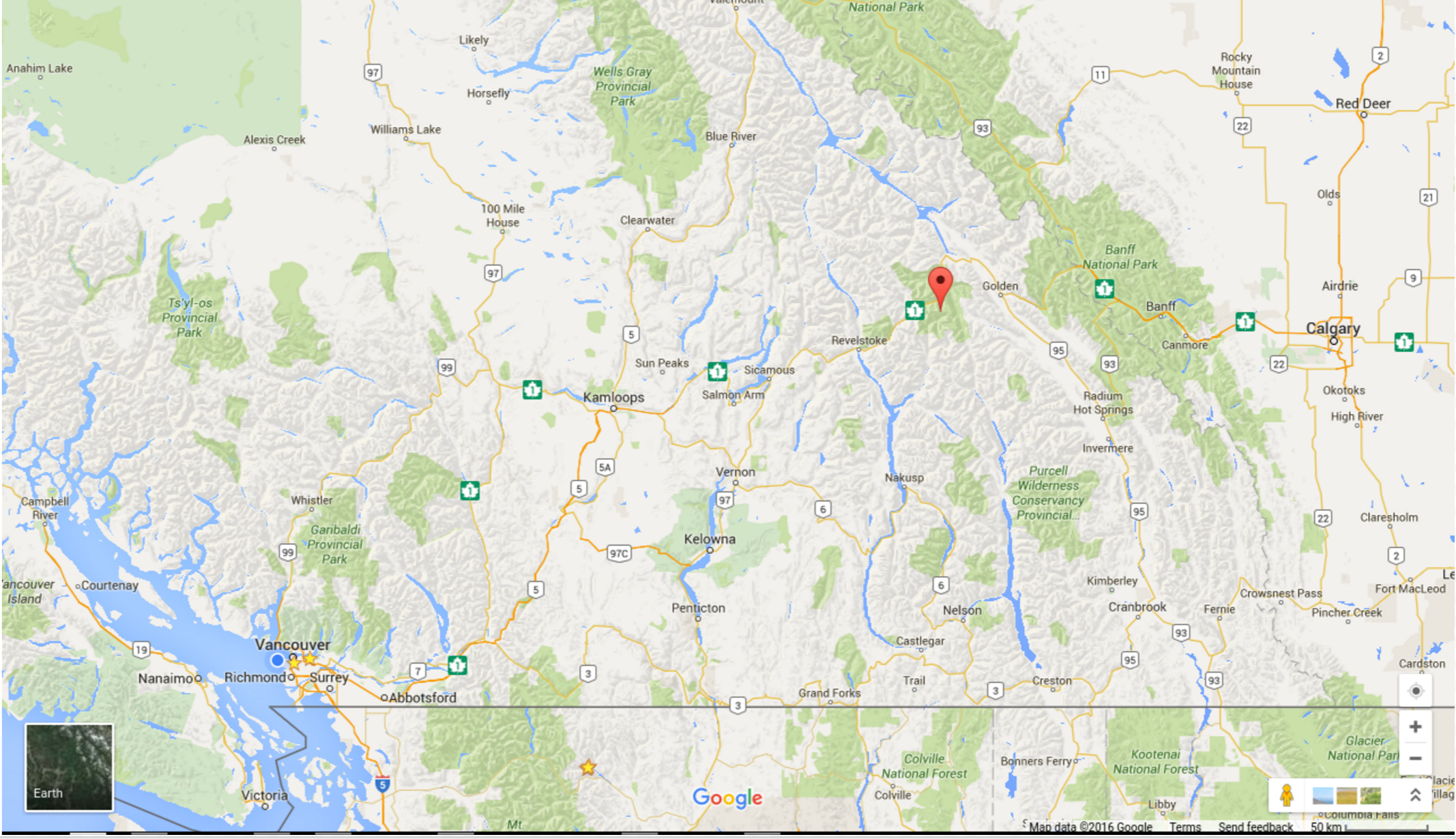
Map showing the overall location of the Saphire Col route (red pin) in the Selkirk Mountains. (Credit: Google)
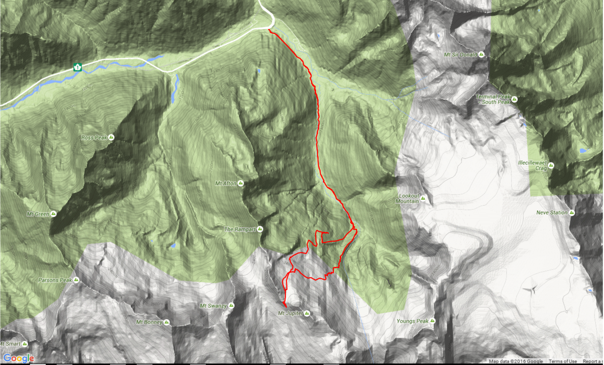
Zoomed in view of the traverse shown by the red line. (Credit: Google/West)
The route begins at ~1300 m elevation and ends at ~2600 m elevation. Note that the route crosses through fairly big avalanche terrain. Likewise, on the slopes you're planning to ski, you can minimize avalanche exposure to some extent, but you will not be able to avoid it entirely.
Figure Credits: Google Earth & Google Maps: Map data (c) 2019 & 2016
Google
verytrail: Map Copyright © 2016 everytrail.com
Map annotations by: Howard: Rosie Howard; West:
Greg West; Stull: Roland Stull
Webpage updated
Jan 2019