ATSC 113 Weather for Sailing, Flying & Snow Sports
Jet Streams
Learning Goal 9b: Describe the location of the jet streams in relation to the global circulations and explain how the ridges and troughs in jet streams create midlatitude cyclones and anticyclones that influence surface weather.
Jet Streams
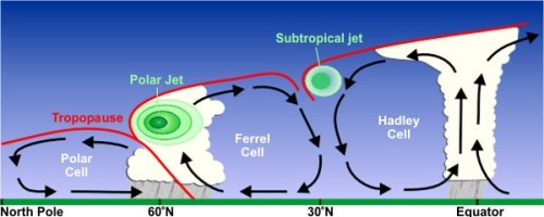
Jet streams are fast flowing, narrow bands of wind in the upper atmosphere that circle their way around the globe. The two major jet streams form where air masses of different temperatures converge. The greater the difference in temperature, the stronger the winds. The jet stream that forms near 60° latitude is called the polar jet stream, while the one that forms at the poleward limit of the Hadley cell is called the subtropical jet stream.
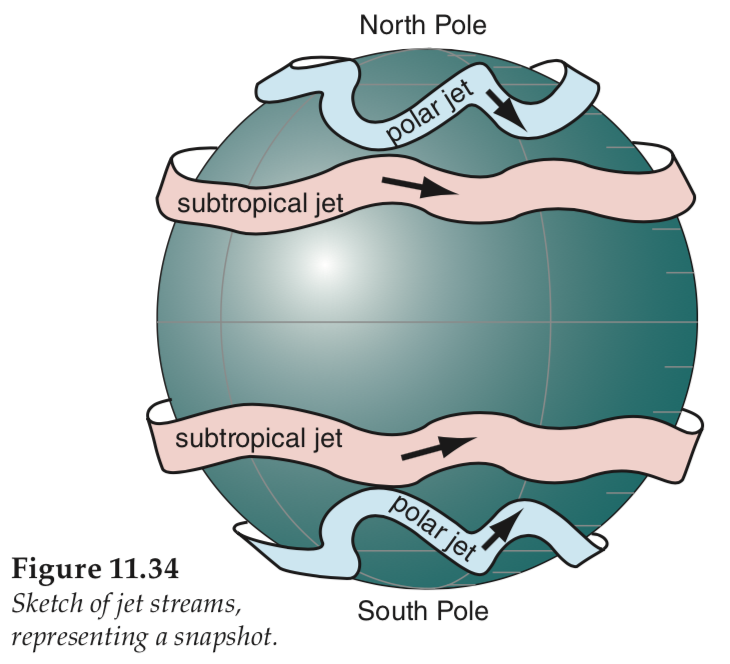
The jet streams flow along the top of the troposphere. They are predominantly westerly winds due to the rotation and relative movement of the Earth, however due to their meandering path, they sometimes veer north or south. Their flow pattern is more like a wave, with troughs (pronounced "trofs", where the jet stream meanders equatorward) and ridges (where the jet stream meanders poleward) for areas of low and high pressure respectively. The contrast between warm tropical and cold polar air is greatest in the winter, and so jet streams blow the strongest in winter.
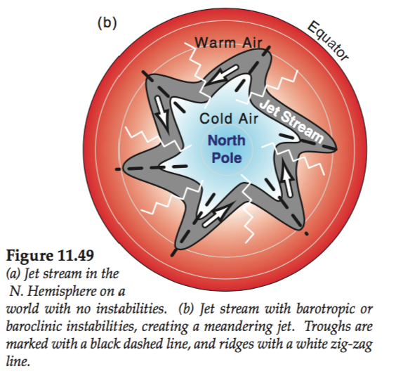
Note: The Ferrel Cell is not actually observed in nature. Instead, at mid-latitudes, are the mid-latitude cyclones (Lows) with their fronts, and anticyclones (Highs). This is illustrated in the Figure in Module 9a. Source: National Weather Service JetStream - http://www.srh.noaa.gov/jetstream//global/images/jetstream3.jpg, Public Domain, https://commons.wikimedia.org/w/index.php?curid=8697888
Mid-latitude Cyclones (Lows) and Anti-cyclones (Highs)
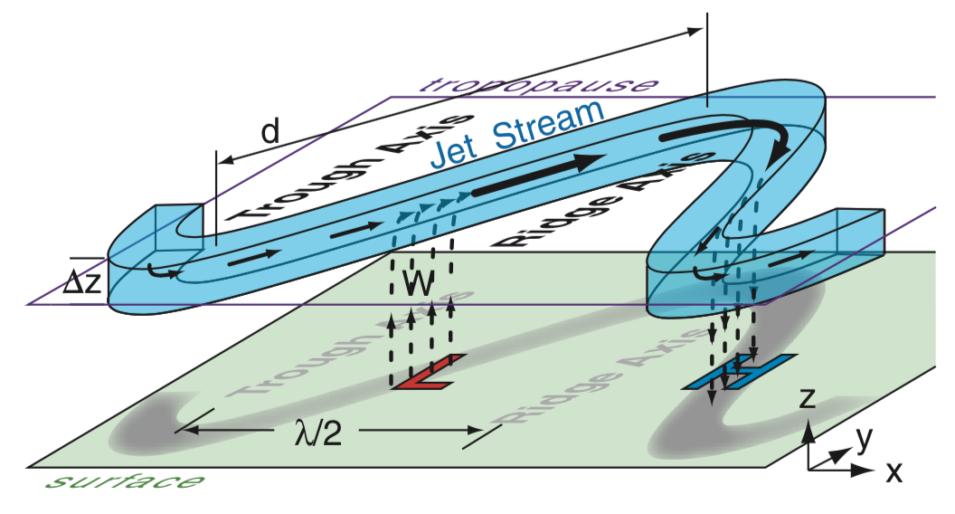
Jet streams have a strong influence on local weather because mid-latitude cyclones (surface Lows and their fronts and bad weather) are created on the east side of jet-stream troughs (about halfway between the trough axis and the ridge, see Figure below). Weather forecasters often use the location of the jet streams and their troughs and ridges to predict weather. For instance, a jet-stream trough (low pressure) just west of your location is often associated with a Low at your location, with locally bad weather (clouds, precipitation, strong winds often from south-east through south-west).But a jet-stream ridge (high pressure) just west of your location is associated with a high pressure over your location, with good weather (light winds from the north-west through north-east), mostly clear skies).
Together, jet streams, cyclones and anticyclones drive much of the
weather experienced in the mid-latitudes.
Recall from earlier learning goals that Lows (L) in the Northern
Hemisphere have winds that rotate counterclockwise around the low (but
in the S. Hemisphere they rotate clockwise), and have near-surface air
that converges and rises. Thus, lows have bad weather, clouds,
precipitation, fronts and strong winds.
Highs (H) in the Northern Hemisphere have winds that rotate clockwise around the high (but opposite rotation in the S. Hemisphere), and they have sinking air that spreads out (diverges) when it reaches the surface. Thus, highs have light to calm winds, clear skies, no precipitation, and fair weather.
As mentioned before, the best sailing is often at locations between
the Low and High pressure centers. Low centers have bad weather
(difficult sailing), and high centers have calm winds (no
sailing). But between highs and lows you can often find
reasonable winds and reasonable weather.
Additional Resources: (non-required material)
A Rough Guide to the Jet Stream: http://www.skepticalscience.com/jetstream-guide.html
Videos: (non-required material)
Global Winds and Jet Streams: https://www.youtube.com/watch?v=GvXPtQuQtiU
Keywords: jet stream, troughs, ridges, Polar cell, Hadley cell, cyclone, anticyclone, front
Image credits: Images created by R. Stull, unless otherwise indicated near the figure.