ATSC 113 Weather for Sailing, Flying & Snow Sports
High Pressure
Learning Goal 5e. Use your knowledge of mean sea level pressure to identify high pressure systems and ridges on pressure maps.
Learning Goal 5i. List the weather conditions associated with a high pressure system and their relevance to snow sports.
We established earlier that pressure is the weight of the air above you (Flying Module Learning Goal 2a). High pressure, also known as a high pressure system or an anticyclone, is a region where pressure is higher than in surrounding regions. It's the boring sibling to the exciting low pressure system. However, for all types of people that like playing in the outdoors, it's the friendlier sibling.
This is where you'll find your bluebird powder days...
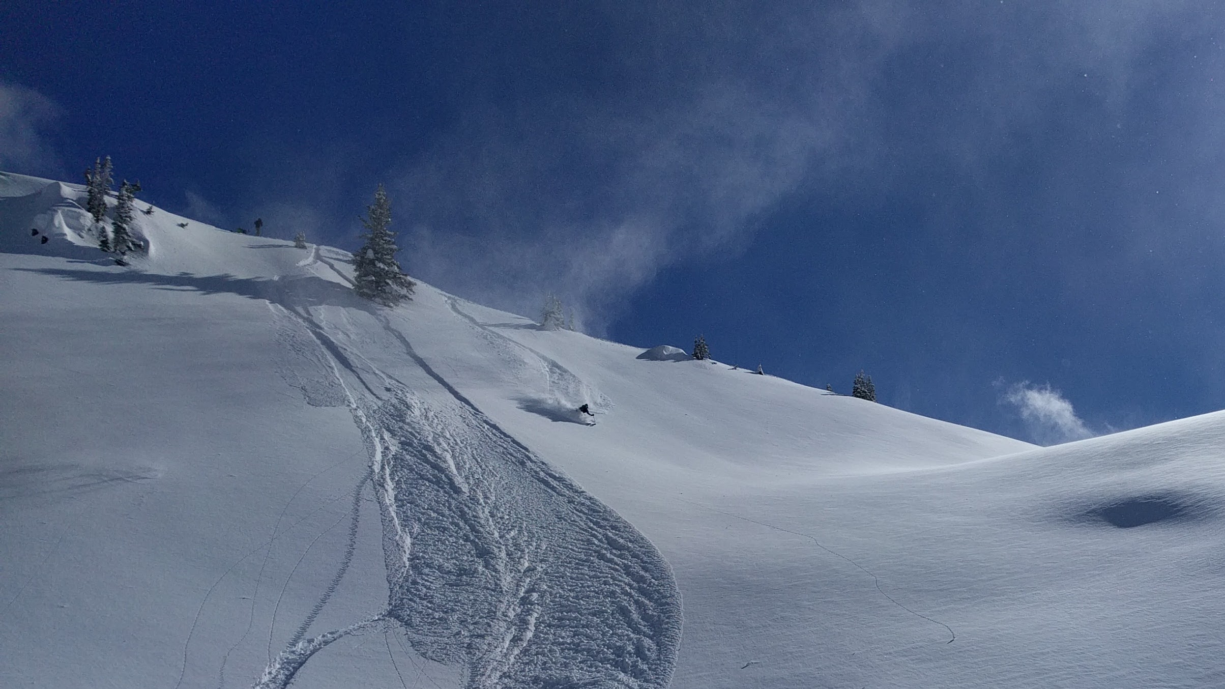
Fig. 5ei.1 - A bluebird powder day in Steep Creek near Duffey Lake Road, BC. (Credit: West)
...bluebird spring skiing days...
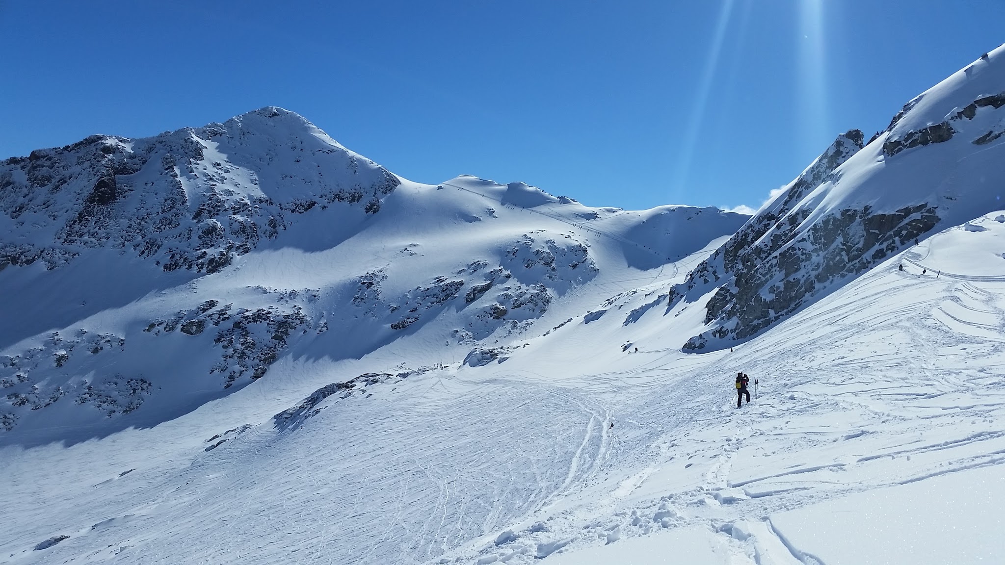
Fig. 5ei.2 - Bluebird spring skiing day at Blackcomb Glacier, BC. (Credit: Howard)
...your best glacier travel days...
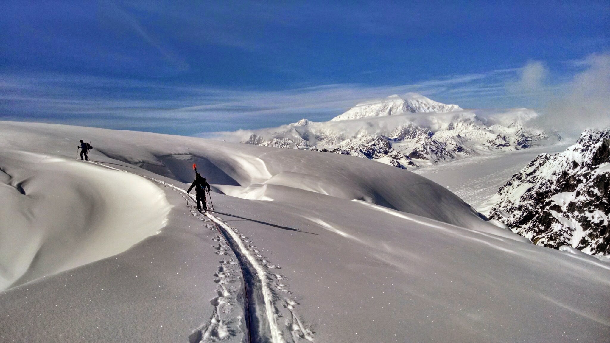
Fig. 5ei.3 - Glacier travel in the Alaska Range, AK, USA. (Credit: West)
...and of course the days with the best views!
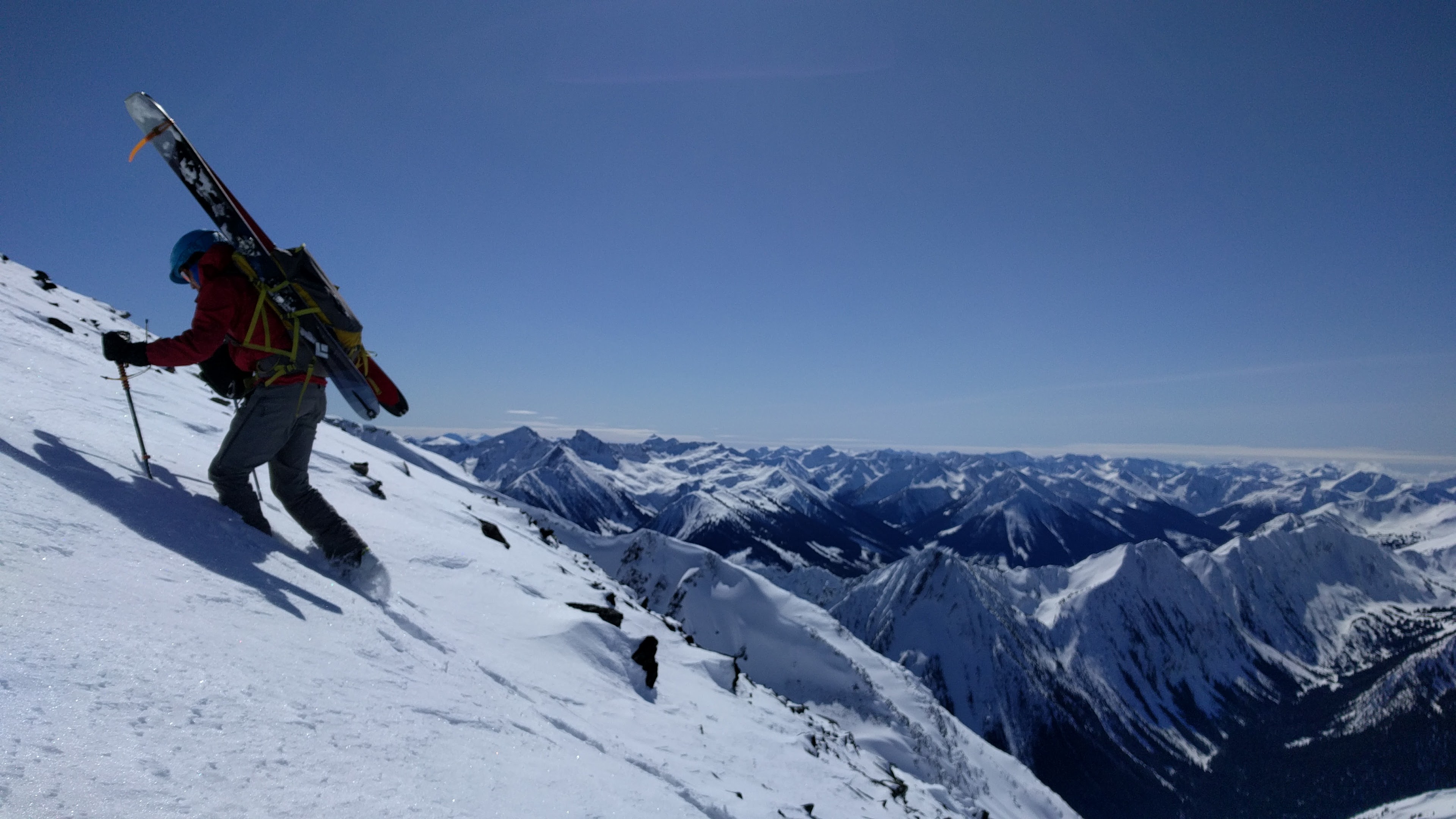
Fig. 5ei.4 - Booting up a ridge in Downton Creek, BC. (Credit: West)
In short, when you're on an outing in the mountains, high pressure makes things not only more enjoyable, but also safer, in most cases. Now, let's learn a bit more about what high pressure systems are, and why they produce this beautiful weather.
-
Pressure Pattern
Weather maps on TV and the Internet often show a surface high (as opposed to high pressure aloft in the troposphere) with an "H". Technically this is not surface pressure, but rather what the pressure would be if the pressure at the surface was reduced to sea level.
Pressure at the Earth's surface varies with elevation over topography (lower pressure at higher elevations). If a map actually showed surface pressure it would look a lot like a topograpical map, and we wouldn't be able to pick out areas of low and high pressure due to weather. Since our focus is on the weather, we want to see pressure patterns due to high and low pressure systems (not due to elevation changes). To overcome this, we calculate what the surface pressure would be if we were down at sea level. The result is a nice looking map of high and low pressure (Fig. 5ei.6). This is known as sea level pressure (SLP) or mean sea level pressure (MSLP).
Pressure is shown on these maps with isobars.
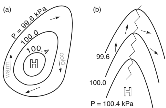
Fig. 5ei.5 - Examples of surface high pressure on a weather map. The contours are isobars (explained below). The arrows show the direction of airflow in a clockwise direction around the high. (Credit: Stull)
Isobars are lines, or contours, connecting locations that have the same pressure.
Isobars can be used to indicate high pressure centres and low pressure centres. Both highs and lows are surrounded by concentric isobar circles, which represent a maximum or minimum in pressure, respectively. A high is a maximum in pressure (Fig. 5ei.5a above), and the isobars around a high indicate that if you travel in any direction away from the high, you will find decreasing pressure values. To think of it in the reverse sense, if you travel towards the high from any direction, pressure will increase as you approach the high centre. This is just like on a topographic map where the lines of constant elevation can show a mountain peak, which is an elevation maximum. The opposite is true for low pressure centres: the values of the isobars they decrease towards the centre. We will discuss this more later.
It's also possible to have high pressure ridges and low pressure troughs. Fig. 5ei.5b above shows a high pressure ridge. The centre, or axis, of the ridge is indicated by a squiggly line. Ridges are areas of relatively high pressure that extend out from high pressure centres. In a ridge, the isobars do not form a closed circle, but rather partially enclose values of higher pressure. If you travel away from a ridge in most directions, pressure will decrease, but not in all directions. If you travel along a ridge towards the high pressure centre it's connected to, pressure will increase towards the high pressure centre. They are visible on pressure maps as "kinks" in the isobars pointing away from the high pressure centre. On a topographical map, pressure ridge is equivalent to a mountain ridge.
Recommended - watch this video: How to Read Temperature Maps.
Let's take a look at a real-world sea level pressure map:
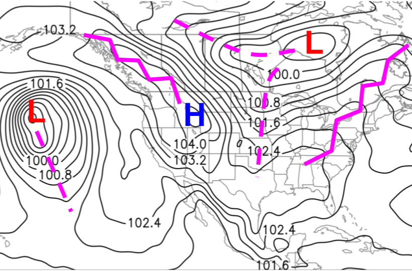
Fig. 5ei.6 - A sea level pressure (SLP, contoured) weather map for a summer's day over North America. (Credit: West)
On some maps highs are marked with an "H" and lows are marked with an "L". Not all contours are labelled with values, so it can sometimes be difficult to infer whether SLP values are increasing or decreasing towards the closed circles that indicate the high and low centres. With practice highs and lows will become easier to identify.
As an example, let's look at the high over northwestern North America in Fig. 5ei.6 above. Its centre is the highest pressure in the region. If you were to travel away from it in any direction, you'd encounter lower pressure values. Now let's look at the high pressure ridge extending northwest from the high. If you approach the ridge axis (squiggly line) from the southwest or northeast (perpendicular to the axis), pressure values increase towards it. However, if you travel northwards along the ridge, pressure values increase towards the high pressure centre.
There is usually a scarcity of precipitation around a high pressure (not shown on above figure), which can also help identify highs vs. lows.
-
Weather Conditions - The "why"
Let's bring it full circle now — why does high pressure bring good weather?
Winds diverge away from the centre of high pressure, flowing from higher to lower pressure. Due to the Coriolis effect, which turns winds to the right (in the northern hemisphere), the wind spirals outward in a clockwise circulation (Figs. 5ei.5a and 5ei.7). Pressure differences are typically fairly weak under high pressure, so winds tend to be lighter. This is important for snow sports, as these low winds can make for ideal ski conditions at the resort. In the backcountry, where you're often far from shelter, low wind conditions are even more important to safe travel.
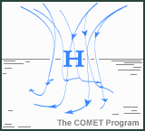
Fig. 5ei.7 - Wind flow around a high pressure system. Diverging at the low levels, spiralling out in a clockwise direction due to the coriolis force, and subsiding from aloft. (Credit: COMET/UCAR)
As winds diverge away from the centre of the surface high pressure, compensating air sinks downward from aloft to fill the void. When air travels downward in the atmosphere, it becomes warmer and drier. For this reason, high pressure systems are typically associated with dry conditions, clearer skies, and a lack of precipitation.
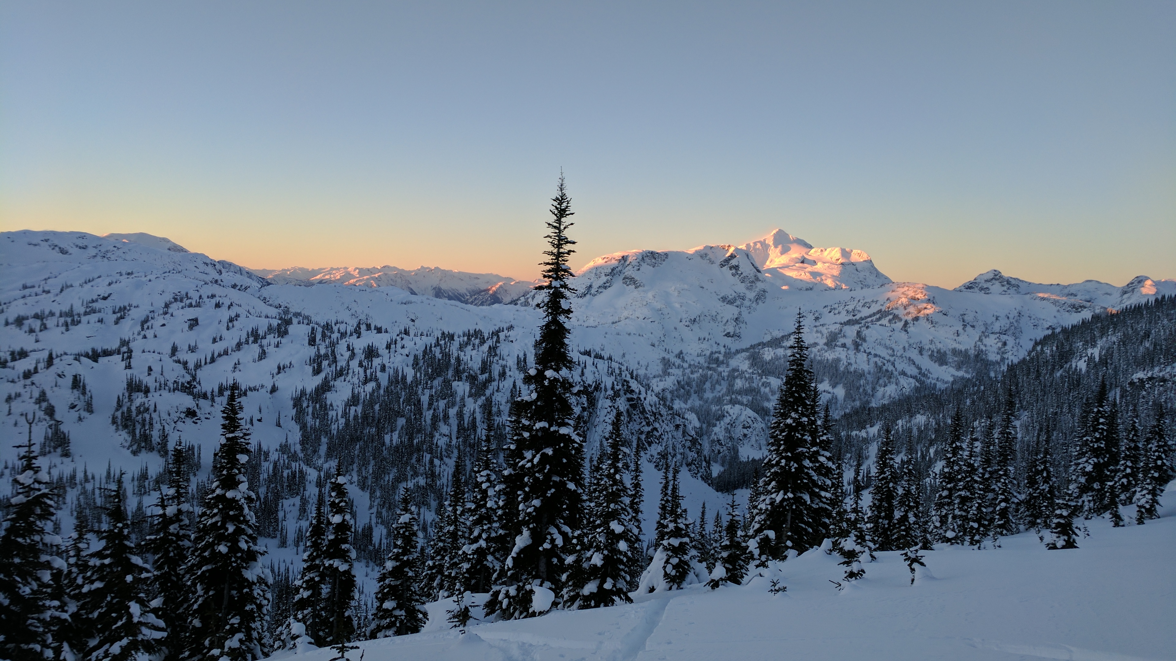
Fig. 5ei.8 - Typical high pressure conditions showing early morning blue sky and alpenglow over Cloudraker Mountain, BC. (Credit: West)
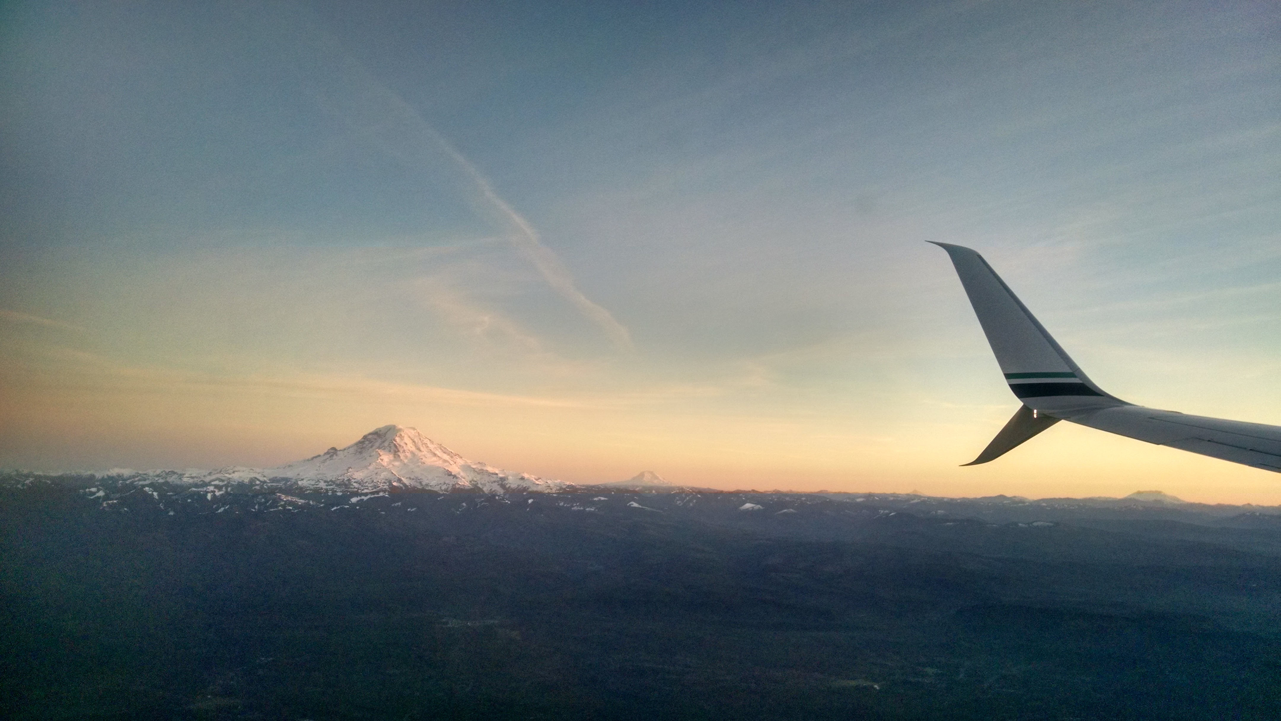
Fig. 5ei.9 - Typical high pressure conditions showing high wispy cirrus clouds over Mount Hood, OR, USA. Good visibility and low winds are perhaps most critical to skiers on high, isolated peaks, like volcanoes. (Credit: West)
High pressure, however, also carries with it some weather hazards. First, with sun and warmth come sunburn, sweating, and dehydration. It's important to cover up when it's sunny, especially while skiing.
Insolation (not to be confused with insulation, which is very different) is a convenient term that refers to incoming solar radiation. It includes all types of radiation from the sun. However, we're concerned with just two types here: visible light and ultraviolet (UV) radiation.
Recall that pressure decreases with height in the atmosphere because there's less air above you the higher you go. This means that when you're at a high elevation in the mountains, there's less atmosphere above you to absorb the insolation. At 3,000 m (~10,000 ft) altitude, there's about 30% less atmospheric protection above you.
Further, snow can reflect more than 90% of light, which means you get hit with most of the insolation again after it reflects off the snow. It's best to cover up as much as possible, and where you're not covered, apply (and reapply) high-SPF sunscreen. This is especially important after about mid-February when the sun is stronger.
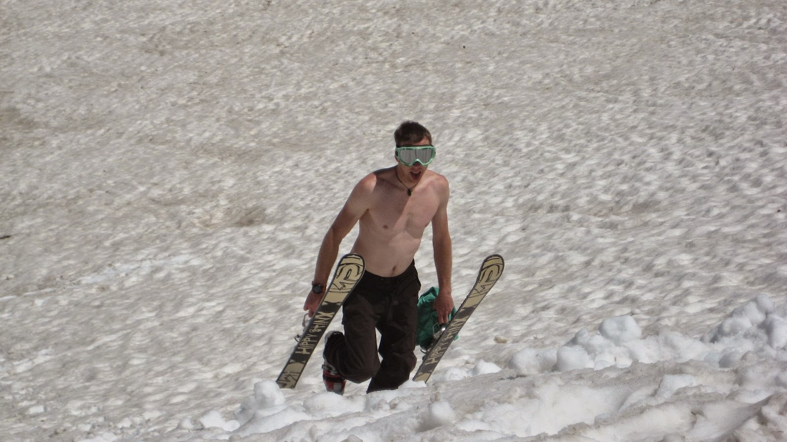
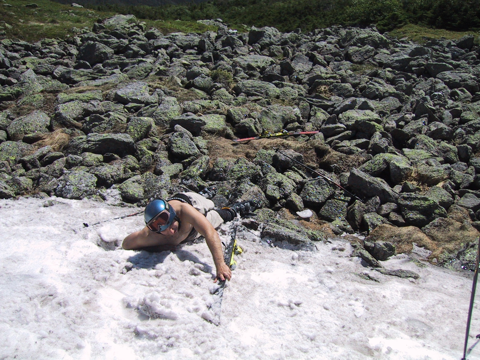
Fig. 5ei.10 - Two examples of poor sun protection during spring/summer skiing. As shown in the second picture, covering yourself also protects against snow rash (spring/summer snow is very abrasive). Left: Sessioning a kicker at Alta, UT, USA. Right: Crashing on a summer snowfield on Mount Washington, NH, USA. (Credit: West)
In the spring, ski tourers and mountaineers often wear a glacier or sun hat with built-in sun protection. Perhaps even more important are special glacier glasses — sunglasses that are very dark, and have side, top, and bottom protection to protect your eyes from exposure to insolation (Fig. 5.ei.11). Insolation (and that reflected off the snow) is strong enough at this time of year that some skiers put sunscreen on the inside of their nostrils, and sometimes get sunburn on the roof of their mouth! Glacier glasses protect against the very real danger of snow blindness. This is a temporarily debilitating blindness, a very real danger on a mountain with hazards where navigation is paramount to survival.
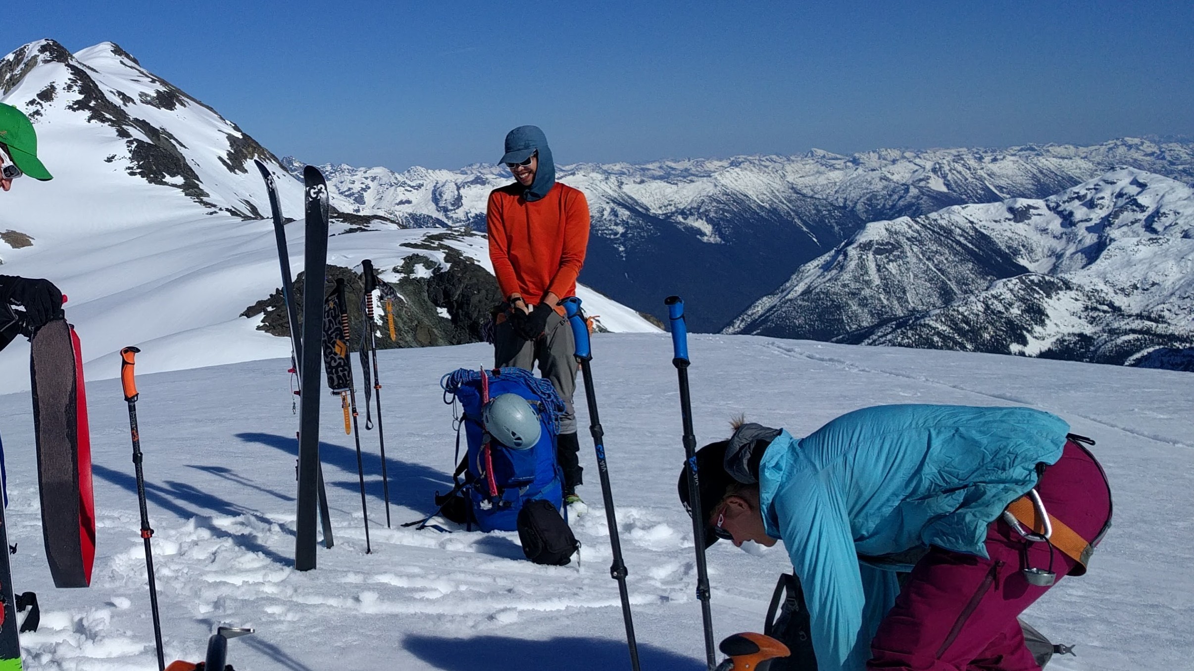
Fig. 5ei.11 - An example of good sun protection coverage on Mount Skook Jim, Stein Valley, BC. (Credit: West)
High pressure does not guarantee nice weather. Occasionally there can be strong winds during a period of high pressure. These may be due to pressure differences associated with an approaching low pressure system, or due to local terrain-driven effects. We'll cover some of these later.
Increasing high clouds (with the approach of a low pressure system) can lead to flat light, where the clouds diffuse the light, and the snow surface no longer has any definition. You'll know it when it happens. You may not be able to tell downhill sections of the slope from flat or uphill areas. You might get caught off guard by a mogul, bump, or gully. It's best to exercise caution and slow, safe skiing under these conditions. Lastly, high pressure is sometimes associated with very cold air temperatures, especially in valleys, along with valley clouds and fog. We'll cover this later as well.
Key words: high pressure, high pressure system, anticyclone, low pressure system, sea level pressure, mean sea level pressure, isobars, ridges, troughs, axis, insolation, flat light
Figure Credits: Howard: Rosie Howard, West: Greg West, Stull: Roland Stull