ATSC 113 Weather for Sailing, Flying & Snow Sports
6 - Snow Sports: Winter Mountain Weather
Learning Goal 6a: Explain the causes and effects of cold air pooling
In Learning Goal 5e and 5i you learned about high pressure . Recall that it is typically associated with nice weather - clear skies, calm or light winds - and that it is also accompanied by a stable temperature profile (Flying Module Learning Goal 3b).
Under these conditions, cold air just above the ground surface can drain or pool into valleys where cloud or fog can form in the cold air. Hazards for skiing include: (1) very cold air in valleys and valley bottoms, (2) cold air temperatures in the downslope drainage flows, (3) valley cloud/fog limiting visibility, and (4) freezing fog when temperatures within the fog are below freezing. Ideally, you would try and plan to ski (and camp) above this cold, sometimes foggy layer.
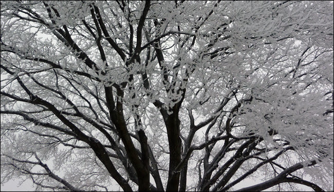
Fig. 6a.1 Tree branches covered with ice from freezing fog. (Credit: NOAA)
Why does cold air sink?
Cold air has less energy than warm air, meaning the air molecules do not move around as much. The molecules are therefore packed closer together, making the cold air more dense. This means cold air has more mass, or the air is heavier per cubic metre, than warmer air. So the cold air sinks beneath the air that is warmer.
Stable vertical temperature profiles just above the ground surface are most common overnight into the early morning hours, and during the winter, especially where there is snow on the ground. Once the sun disappears below the horizon, the ground loses its heat source and starts to cool. Optimal cooling conditions include clear or mostly clear skies, and calm or light winds, e.g. under high pressure. If there was cloud cover, it would absorb the heat energy from the surface and reradiate it back to the surface. However, with no clouds, the heat is lost to space. In the mountains, under these conditions, the cold air near the surface tends to pool into valleys because it's more dense than the air that it is replacing farther down valley.
This downslope movement of air that occurs in the absence of
larger-scale wind flows is known as a katabatic wind ,
or drainage flow/wind (Learning Goal 6b), and leads to cold air pooling within
mountain valleys. The downslope flows from
smaller valleys (called subdrainages) converge in the main valleys,
where the cold air accumulates. Cold air pooling can strengthen an
already surface temperature inversion,
where temperature increases with height (Learning Goal 6c).
So if this happens at nighttime, then why do skiers care?
- The effects can last beyond sunrise. Drainage flows continue all night, building cold pools until the sun starts hitting the valleys and slopes the next morning. Even then, it can take several hours for the cold pool to dissipate. So if you start your ski day early in the morning when there is high pressure, you may be misled into dressing for colder temperatures than necessary. Often mid-mountain temperatures will be warmer than the valley bottom, due to the inversion. As you continue up towards the peak, however, temperatures may begin to cool again as you travel above the inversion, and temperatures decrease with height.
- The effects can persist for multiple days. Cold air pooling strengthens inversions. As we discuss further in Learning Goal 6c, inversion episodes can persist for days or even weeks under persistent high pressure in the dead of winter.
- A lot of people ski at night! Many ski resorts have night skiing, with floodlit ski runs. The local mountains on the north shore of Vancouver all offer this: Seymour, Grouse, and Cypress Mountains. While you can often get above the fog, sometimes the layer is so deep that it might affect you on these lower elevation mountains.
- Backcountry trips may start or end in the dark (Fig. 6a.2), and may include camping overnight. Campsite selection should be done with an awareness of these processes. Setting up a tent or bivouac sack in a valley bottom under cold, clear conditions, will expose your camp to the coldest temperatures and to the drainage flow. It's often better to set up camp a little way up the mountainside, so that you're still sheltered from potential large-scale winds, but also avoid the cold drainage flows of the valley bottom.
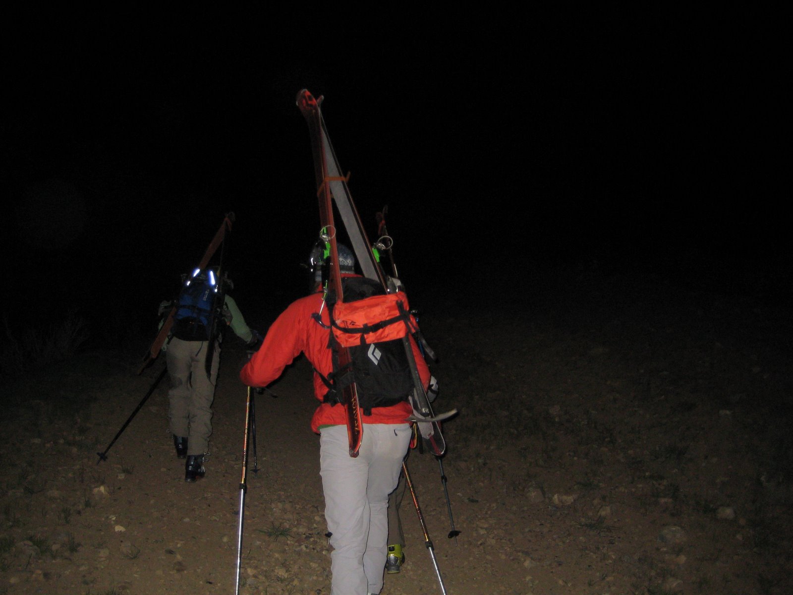
Fig. 6a.2 Backcountryskiers making an "alpine start" - a very early start to the day to make good progress into the alpine - from the valley in the dark and cold. (Credit: West).
Keywords: high pressure, stable, katabatic wind,
cold air pooling, temperature inversion
Figure Credits: Howard: Rosie Howard, West: Greg West, Stull: Roland Stull