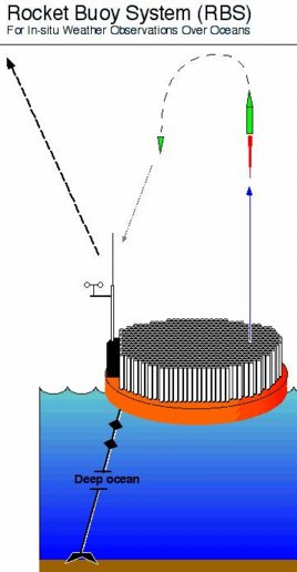
Fig 1. Rocketsonde buoy concept, with a year's supply of rockets sealed in their individual launch tubes.
One of Prof. Stull's research projects is the development of a weather rocketsonde system (Fig 1). These sondes will be launched from buoys in the Pacific Ocean, to improve forecast skill over British Columbia.
Fig 1. Rocketsonde buoy concept, with a year's supply of rockets sealed in their individual launch tubes.
During summer 2002, his team (Catherine Readyhough, John Spagnol, Mark, Jenn Mundy, Prof. Sheldon Green, Prof. Gary Schajer) constructed and tested a variety of rockets (Fig 2) to find the smallest one that could reach 6 km altitude.
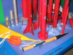 Fig 2. Rockets built at UBC.
The weather-sonde payload for these rockets is proposed to be an existing rocketsonde sensor package (Fig 3) built by Vaisala. This probe measures temperature, humidity (Fig 4), and pressure while descending on parachute from its release point at the apogee of the rocket trajectory.
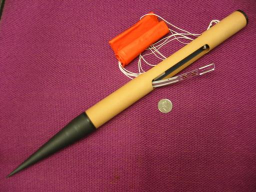
Fig 3. Rocketsonde payload. A quarter is shown for scale.
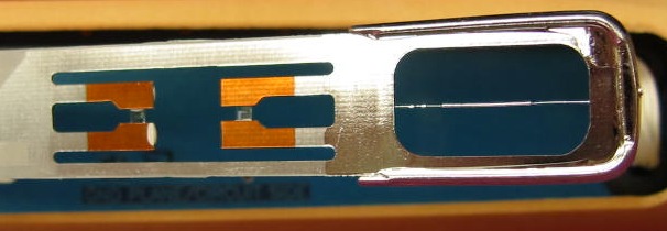
Fig 4. Close-up of the sensor probe. Shown are the thermister (thin silver wire in frame at right) and the 2 humicaps (tiny clear plastic squares held between the orange arms).
One concern was the radio-transmission range from these very small sondes (which were originally designed to transmit from only 1 km altitude. To test the transmission range of this rocketsonde, we attached it to a weather balloon and launched it from the roof of the UBC EOSC-east (Fig 5) bldg at about 2:45 pm PDT on 26 Sep 2002. According to GPS, the launch location is x = 49deg 15.754 min N, y = 123deg 15.104 min W, z = 102 m MSL.
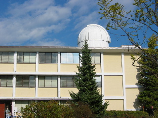 Fig 5. EOSC-east bldg.
The weather was scattered to broken mid and high level clouds (Fig 6), with nearly calm winds at the surface, and a temperature of about 20 C.
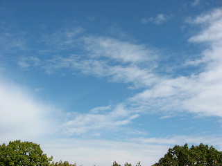 Fig 6. Sky condition prior to launch.
To assist in the launch test were many of Stull's grad students, colleagues from Environment Canada, and a student from the ATSC 201 course (Fig 7). We inflated a "100 gram" latex weather balloon with helium (Fig 8).
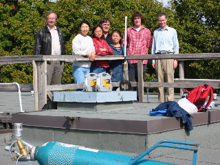
Fig 7. Collagues ready to help Left to right: Laurie Neil, Yongmei Zhou, Xingxiu Deng, John Spagnol, Li Huang, Philip Austin, Robert Nissen.
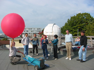
Fig 8. Colleagues beginning to inflate the balloon with helium. Left to right: Laurie Neil, Yongmei Zhou, Luca Delle Monache, Xingxiu Deng, Li Huang, Haizhen Sun, Robert Nissen, Catherine Readyhough, John Spagnol.
The balloon was inflated to about 1.5 m diameter, attached with a long line to a parachute, which in turn was attached to the sonde (Fig 9).
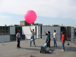
Fig 9. Stull holding balloon, parachute, and sonde, seconds before launch.
The launch was successful, and the balloon rose almost vertically (Fig 10) for the first couple minutes in the calm near-surface winds.
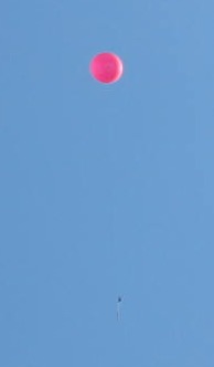
Fig 10. Balloon shortly after launch, with the sonde just visible hanging below it.
As luck would have it, the laptop computer that was recording the data failed shortly after launch. However, we had a backup on hand, and quickly hooked it up and starting recording data. Unfortunately, we lost the bottom 3 km of initial rise of the balloon. After re-acquiring the sonde transmissions, we received data as the balloon rose to about 8 km above the ground, and also after the balloon burst and the sonde descended by parachute (top insert in Fig 11).
Fig 11. Top insert: Pressure (P) altitude of balloon with time, measured in seconds relative to an arbitrary starting time. Data was normally taken every second, except for some temporary outages due to weak reception. Geometric altitude (z) is just a crude estimate, based on the standard atmosphere.
Bottom graph: Emagram sounding of temperature (T) vs. pressure, produced on a computer spreadsheet. The temperature observations are shown as dark red dots and blue circles when the sonde was ascending and descending, respectively. Dew point is in green. For reference, dry adiabats are in orange, and a moist adiabat is the violet dashed line.
We can compare these with 00 UTC 27 Sep 2002 soundings made nearby from Port Hardy, BC (CYZT, north of UBC) and Quillayute, WA (KUIL, sounth of UBC). The KUIL sounding is shown in Fig 12 as a Stuve diagram (graph produced by the Univ. of Wyoming), and the CYZT is shown in Fig 13 as an Emagram (graph produced by UIUC). Also, the text versions of these soundings are also available for CYZT and KUIL .
Fig 12. Stuve diagram of KUIL sounding (5 pm local time 26 Sep 2002).
Fig 13. Emagram of CYZT sounding (5 pm local time 26 Sep 2002).
For comparison, the data points from KUIL and CYZT are replotted on the sounding we made at UBC (Fig 14).
Fig 14. Comparison of soundings from UBC, KUIL, and CYZT.
Copyright © 2002 by Roland Stull
UBC EOSC Dept.