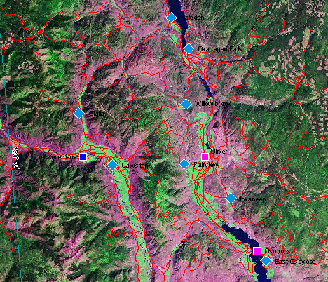
Multiple maps of the area
Here are 20 different maps generated from the BC Government's online "MapPlace" facility (which needs a free browser plugin). Roll your mouse over on the left hand list of labels to change the image.
Regional maps
Mouseover on links
changes the map.
- location map
- roads and rivers
- landsat
- shaded relief
- coarse topography
- forestry information
- regional parks info
- mineral ranking (BC)
- minfile status
- all geology
- rock type and lithology
- faults
- volcanics
- metamorphics
- sedimentary rocks
- intrusives
- geology - ages
- geochemistry (copper)
- geochemistry (lead)
- aeromagnetics
From http://webmap.em.gov.bc.ca/mapplace/minpot/bcgs.cfm