Mapping of Geological, Structural and Topographical Controls - Rufi Landslide Area |
|---|
|
In March of 1999, melting snow cover combined with heavy rainfalls in the northeastern part of Switzerland resulted in the occurrence of numerous shallow landslides. This diploma thesis project involves the investigation of one such slide and the surrounding area; notable because of the geological factors contributing to the slide and the large number of preserved features characteristic of shallow sliding masses. Located in subalpine Molasse of northeastern Switzerland, 2 km east of the town of Rufi in the Lithebene (Canton St. Gallen), the slide involved the mass movement of surficial soils and a conglomerate rock unit with a maximum displacement of approximately 100 m. The shear surface appears to coincide with a smooth marl surface and signs that the slope was heavily saturated are still present. Damage relating to the slide includes the destruction of a paved single-lane road and approximately one square kilometer of forested and pastured land. Given the apparent conditions contributing to the slope failure, similar slides within the region are highly probable. Based on this preliminary assessment, the objectives of the diploma study are as follows:
In this respect, the project will involve several components of mapping and slope stability analysis including: detailed mapping of tensile, compressional and transverse shear features within the slide mass and near it's toe (approximately 1:100 scale); detailed mapping of the slide geometry, geology and geomorphology (approximately 1:500 scale); mapping of regional geology (1:10,000 scale) in a 2-4 km² area surrounding the slide; analysis of pre-slide conditions and stability assessment of similar slopes within the mapped region. 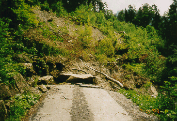 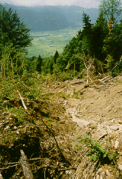
|
| In Collaboration With: |
|
|
| Contact: |
|
|