ATSC 113 Weather for Sailing, Flying & Snow Sports
Wind Shear at Aerodromes (Airports) > Gap Winds
Learning Goal 2e. Identify the causes and typical locations of wind
shear at aerodromes (continued)
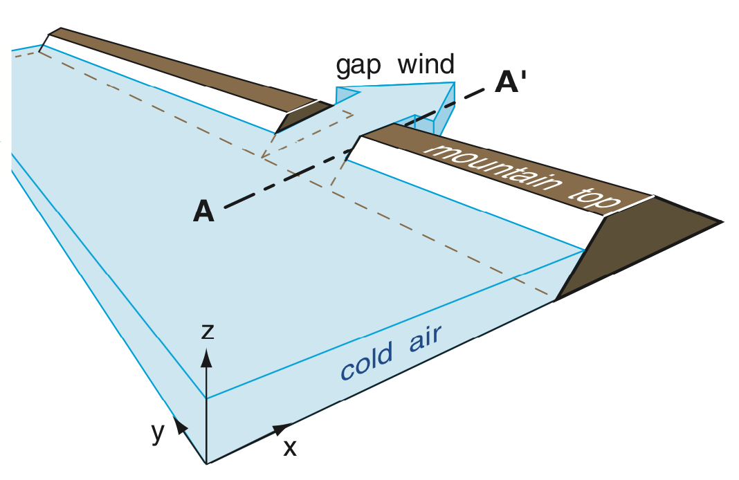
Gap Winds (through mountain passes and fjords)
In the winter, when cold air is trapped behind a mountain range, the cold air can flow at high speed through mountain passes and other gaps between the mountains:
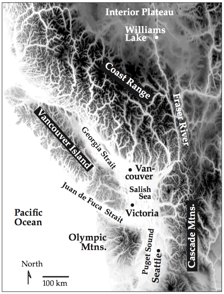
This also applies to gap winds down narrow fjords, or through straits, such as shown as the white (low elevation) regions in the otherwise dark (high elevation) terrain of the map below for southwestern BC and northwestern WA. In this example, cold Arctic air in winter that sweeps southward through British Columbia can get trapped behind of (northeast of) the Coast Range mountains. The cold air then rushes out through the fjords and valleys (white lines) toward the Georgia Strait. These winds not only affect aircraft, but also ships.
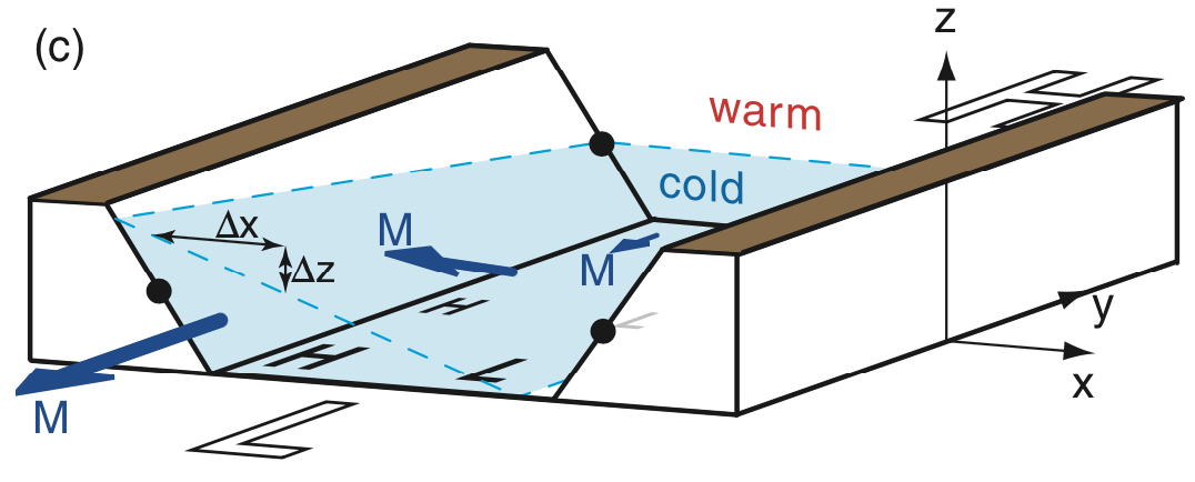
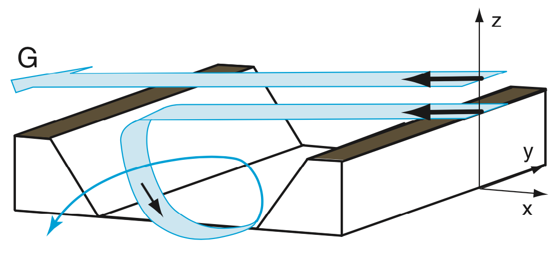
The gap winds are strongest when the cold air near the ground is trapped under a strong temperature inversion. Namely, the air is several degrees warmer just above the top of the cold air, as might occur in winter. In this case, as the winds flow through the gap, the cold air outflow is slightly deeper on the right side of the gap (relative to the air flow direction) in the Northern Hemisphere. See the diagram below, where the cold air is in the high-pressure (white H) region, and is flowing at speed M through the gap toward the low-pressure region (white L). This is the strong-wind case for gap flows.
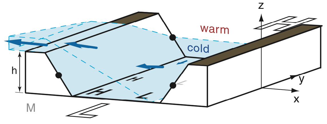
For a weaker temperature inversion above the cold air, such as might happen in spring or fall, some of the air flows through the gap (but not as fast as in the previous figure) and some spills over the side of the valley. See the next figure:
In the summer when there might not be any temperature inversion below the ridge tops, the air might not flow through the gap at all, but instead becomes very complex turbulent swirls, as shown next:
Barrier Jets and Coastally Trapped Low-level Jets
Sometimes a low-pressure system will approach a mountain range, such as when a Pacific low approaches Coast Mountains along the British Columbia (BC), Washington (WA), or Oregon (OR) coast. The cold front marks the leading edge of cold air come from the northwest. When that cold front hits the mountain range, it can sometimes stop there because the cold air is blocked by the mountains.
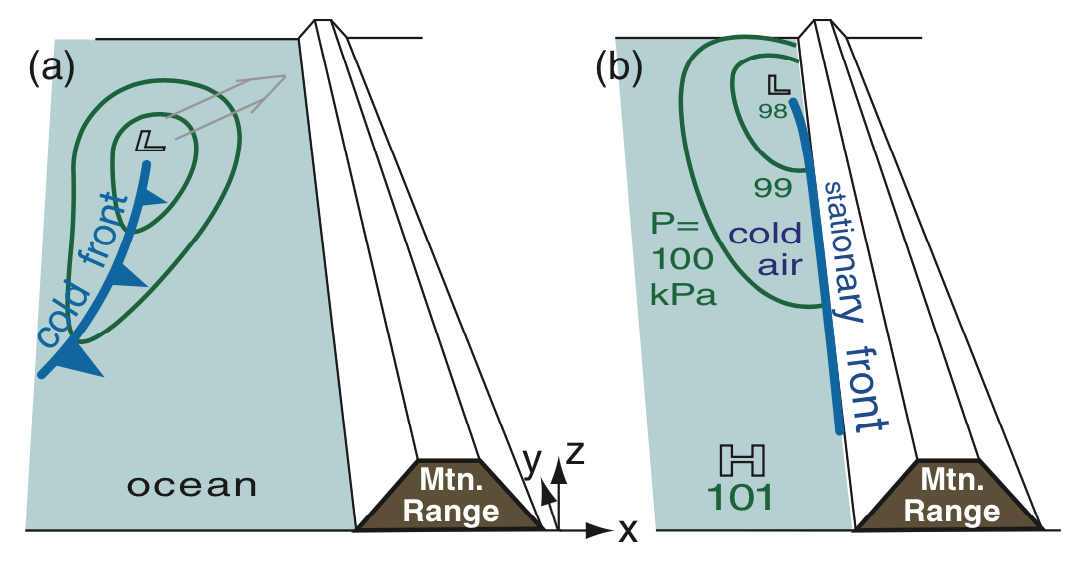
So this situation has cold low-level air, often under a strong temperature inversion (represented by the ∆theta symbol in the figure below), dammed behind a mountain. In this cold air is still the lower pressure to the north, associated with the low (L) that approached the coast. The result is a south-to-north pressure gradient (change of pressure with distance), as shown below.
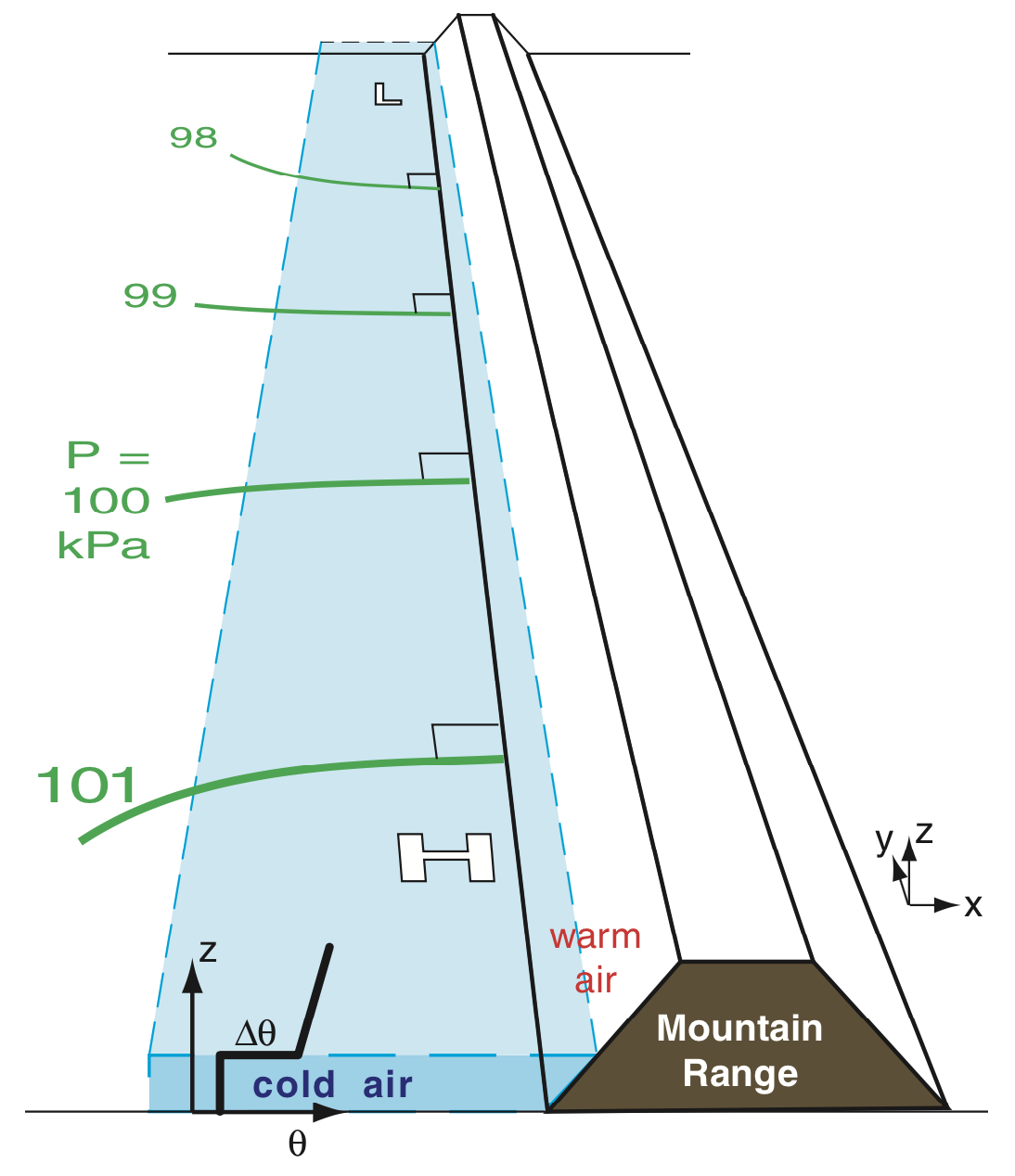
The pressure gradient drives a low-altitude wind in the cold air.
That wind is parallel to the mountain range, flowing from high to low
pressure (south to north in this example), as shown next. This
wind is called a barrier jet.
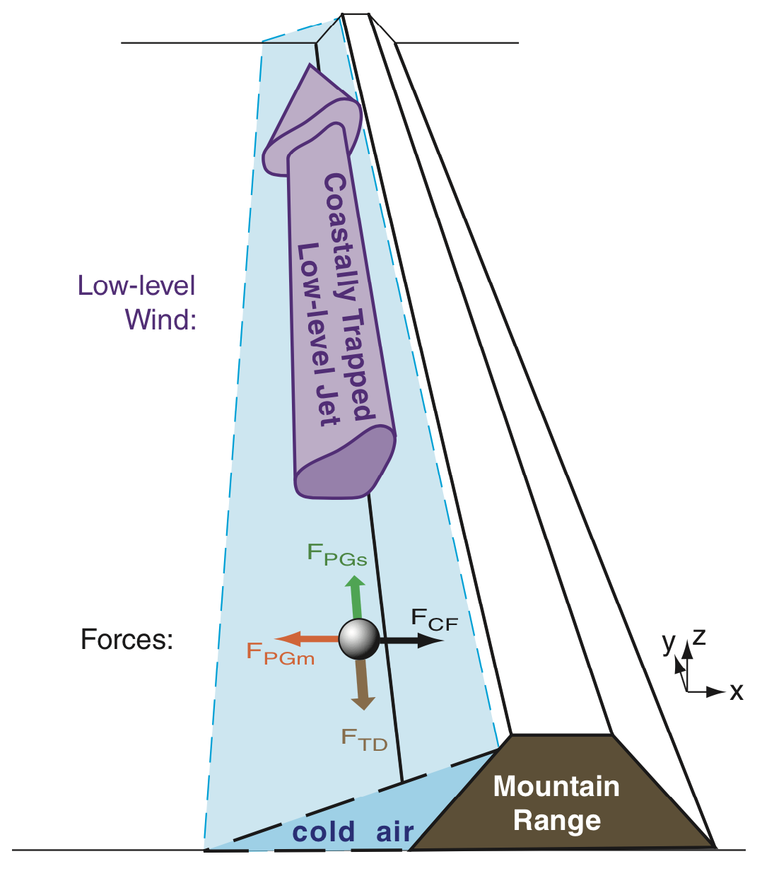
If any airports are located near the coast, then the strong change in wind speed close to the ground (associated with this low-level jet) can make landings and takeoffs difficult. It can also affect wind experienced by sailboats.
Key words: fjords, straits, gap winds, barrier jet
Extra info for experts; not needed for this course.
- See Stull 2017: Practical Meteorology. Chapter 17.
Image credits. All the drawings were made by Roland Stull, and all are copyright by him and used with his permission.