Frontal Hazards
Learning Goal 3h. Locate likely areas of turbulence, icing, and thunderstorms relative to warm, cold, occluded fronts, and dry lines, and describe how these frontal hazards affect aviation
Contents:
A) Overview of Fronts
B) Frontal Conditions at the Earth's Surface
C) Frontal Weather Above Ground
D) Occluded Fronts
E) Dry Lines
F) Fronts and Aviation
A) Overview of Fronts
On weather maps, the boundary between warmer and cooler air is
called a front. If the cold air
advances, it is a cold front. If the
cold air retreats, it is a warm front.
If the boundary doesn't move very much, it is a stationary
front. If the cold front catches up to and merges with the warm
front, the result is called an occluded front.
Another type of front is a dry line. These are explained in more detail below.
Fronts often have clouds, precipitation, strong winds, and turbulence - - all could be flight hazards, as explained below.
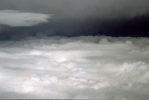
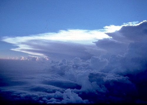
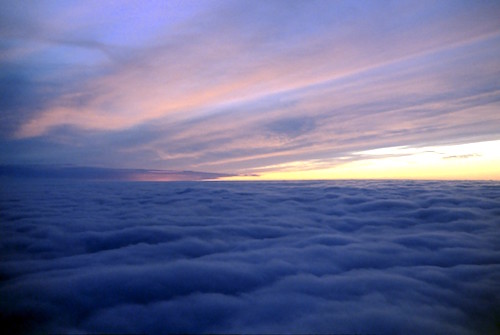
— Flying between cloud layers near a warm front.
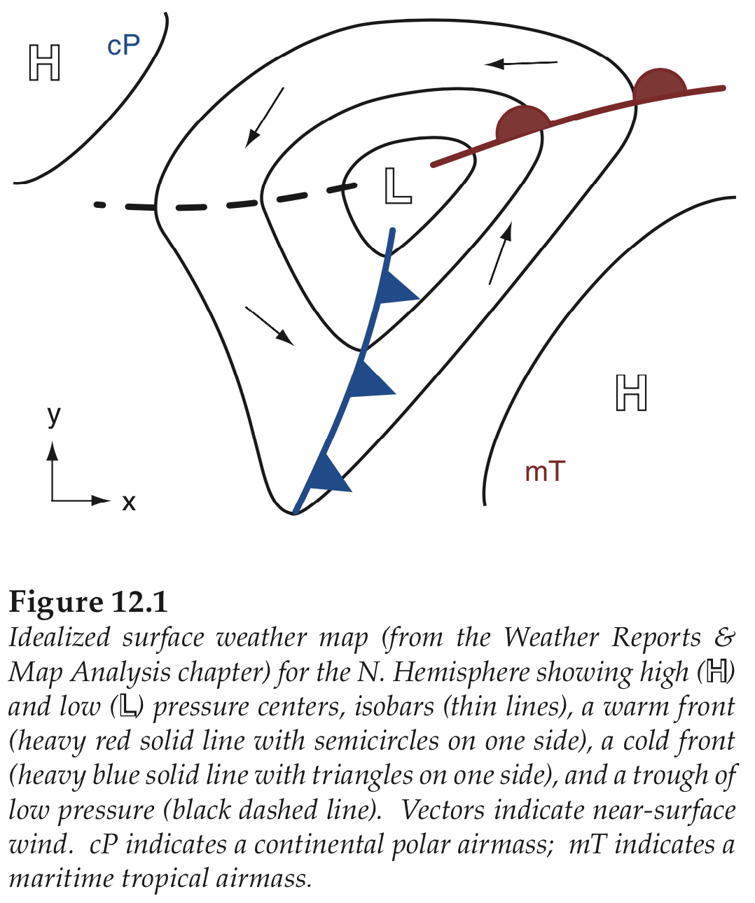
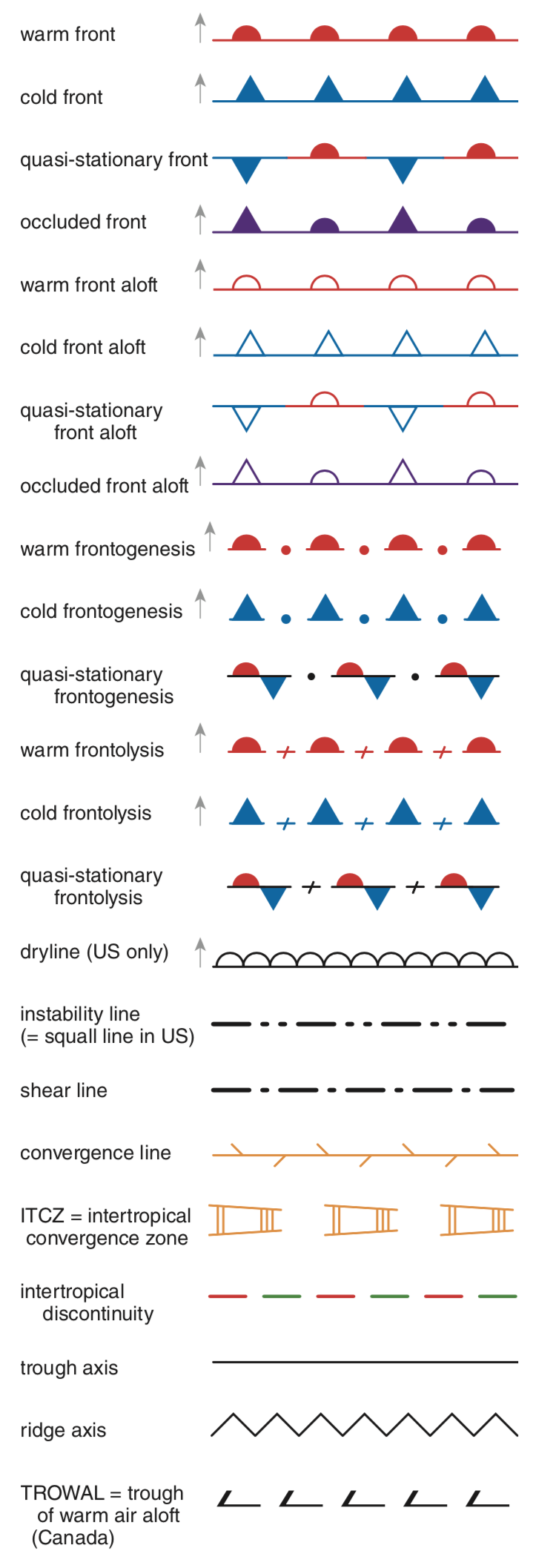
Fronts often rotate around a low-pressure center (a "low") similar to spokes around a wheel hub (see Fig. 12.1 below). Also below is a list of the symbols for different fronts. In that frontal list are some definitions: frontogenesis = birth of a new front; frontolysis = death of an old front; squall line = line of convection / thunderstorms along or ahead of a front.
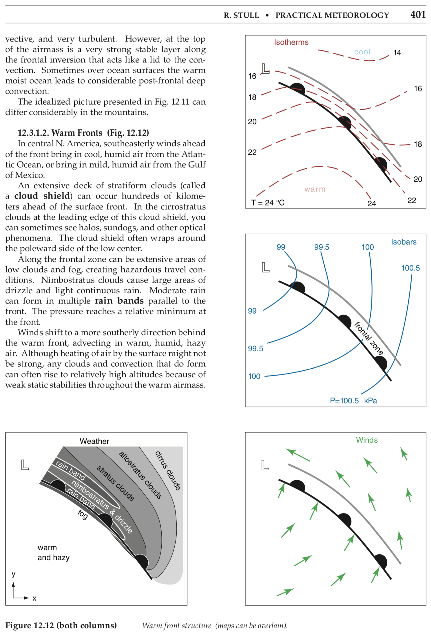
B) Frontal conditions at the Earth's surface
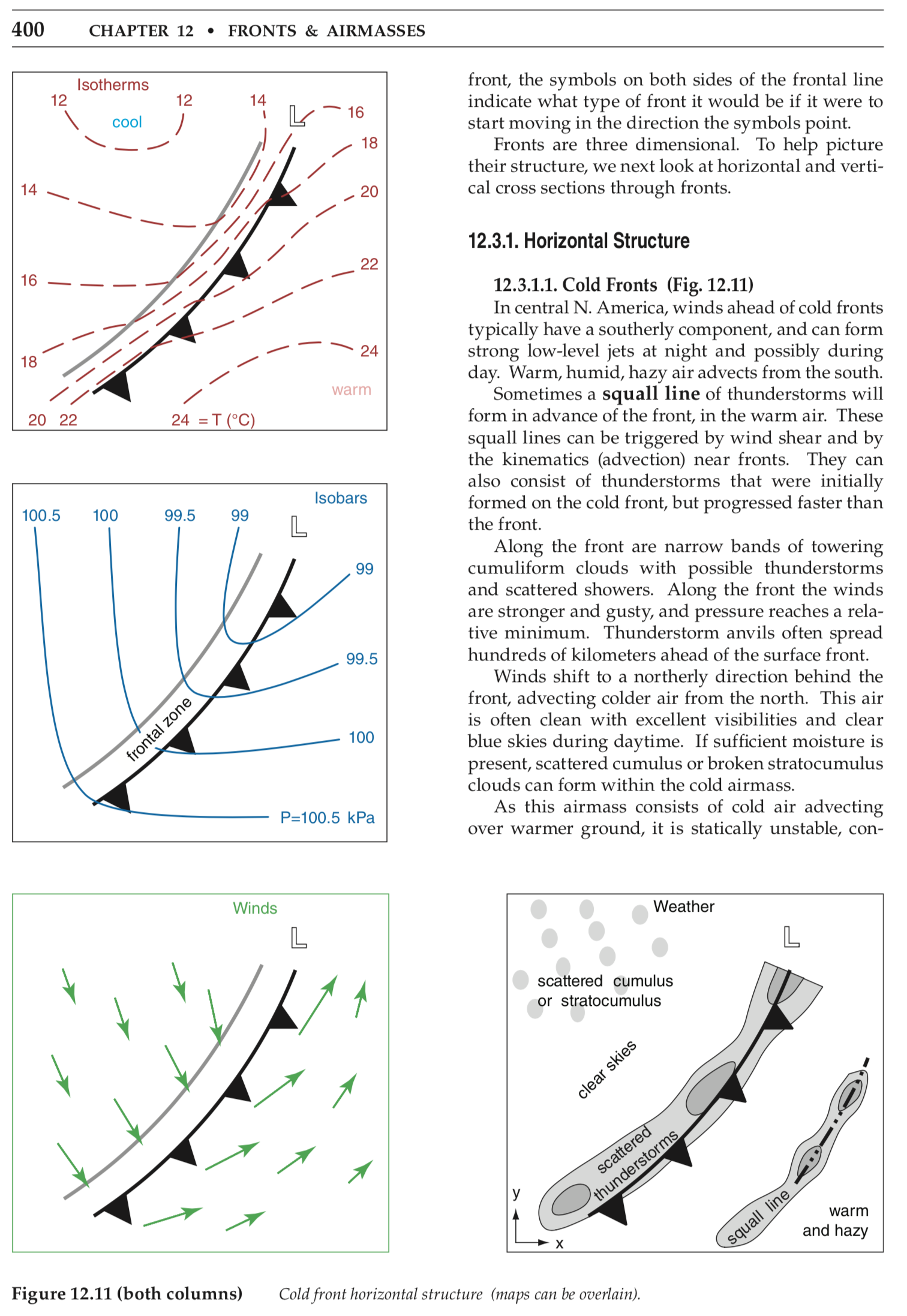
Temperature is not the only thing that changes across the front.
Also changing are wind speed and direction, clouds, humidity, etc. The
diagrams below (from Stull's book "Practical Meteorology") show some of these changes for cold fronts, and for warm
fronts. Isotherms show temperatures. Arrow lengths indicates wind
strengths. These diagrams show how weather varies in the horizontal.
Cold front at the Earth's surface. Actual
temperatures depend on the season.
Warm front at the Earth's surface. Actual temperatures depend on the season:
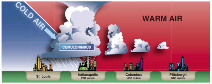
C) Frontal weather above the ground
Pilots are also concerned about weather above the Earth's surface. If we make a vertical slice through the atmosphere across a cold front and a warm front, the results are shown in the diagrams below. Higher in these diagrams correspond to higher above ground. The figures below and above confirm that cumuliform clouds (such as thunderstorms) are often found at cold fronts, and stratiform clouds are often found at (and ahead of) warm fronts. Cloud types are given in Learning Goal 1a.Cold front (a vertical slice through the atmosphere):
.
Warm front (a vertical slice through the atmosphere):
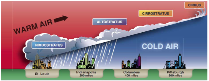
— Figures courtesy of US FAA, AC 91-74B (2015).
 —Thunderstorms along a cold front. |
 —Stratus clouds ahead of a warm front. |
D) Occluded Fronts
Occluded fronts come in two flavors: cold occlusions and warm occlusions. They both occur when a cold front catches up to a warm front. Where very cold air catches up to, and under-rides, cooler air, then the result is a cold front occlusion. Where cool air catches up to, and over-rides, colder air, then the result is a warm front occlusion.
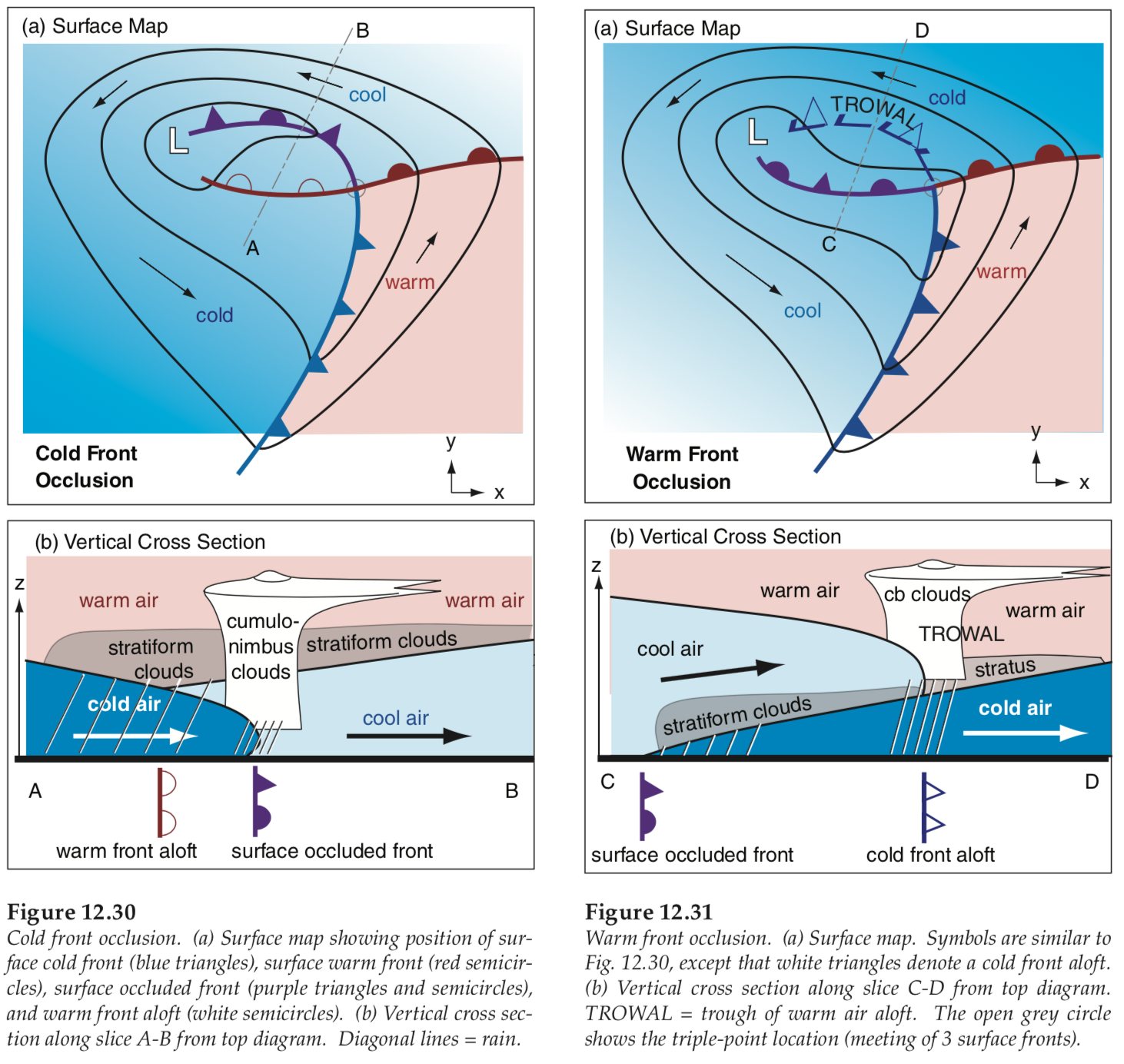
Regardless of the type of occlusion, there are two characteristics that are important to pilots:
- The resulting clouds and weather are a combination of widespread stratiform drizzle and focused intense thunderstorms. Namely, an IFR pilot could encounter dangerous thunderstorms embedded in gentle stratus clouds. Or a VFR pilot could be flying between stratiform layers and have part of the route blocked by a thunderstorm updraft tower (see figures below).
- The warmest air between the cold and warm fronts is pushed upward above the collision between the cold and cool air, causing fronts aloft.
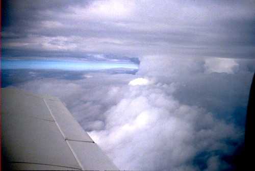 — Thunderstorm (right center) between two stratus layers. |
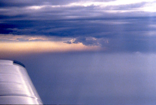 —Thunderstorm (right center) between two stratus layers. But this thunderstorm is harder to see. |
E) Dry Lines:
The boundary between dry and humid air of virtually the same temperature is called a dry line. Don't let the word "dry" deceive you - - it can still be dangerous. Drier air is denser than the moister air of the same temperature. The less-dense moist air will rise over the more-dense dry air, which can trigger thunderstorms along the dry line. Although a dryline cannot be called a cold front or a warm front (because the temperature is often nearly the same on both sides of the front), it behaves very similar to a cold front in its ability to trigger thunderstorms. See more info above and below about cold front hazards.
F) Fronts and Aviation
Frontal Hazards to Pilots
- VFR pilots (i.e., not flying on instruments) encounter clouds, precipitation, low ceilings (= low cloud base), and poor visibility near the front that can block their intended flight (Learning Goal 1g).
- Strong winds can occur near fronts, including wind shifts with time and wind shear with altitude. The result could be headwinds that slow the flight and require the aircraft to consume more fuel. Strong crosswinds at small airports could prevent safe landings. See Learning Goals 2d and 2e.
- Thunderstorms, which have many flight hazards (Learning Goal 4b) can occur along cold fronts and can be hidden inside occluded fronts.
- Depending on the season, if the cold air near the ground is below freezing and the air above the front is warmer than freezing, then rain falling from warm air layers into lower cold layers can become supercooled to create aircraft icing hazards and freezing rain (Learning Goal 3g).
- Drylines behave as cold fronts and can trigger dangerous thunderstorms.
- Heavy snowfall during frontal passage could temporarily close an airport until the snowplows can clear it.
What Can Pilots Do?
- Do their homework before taking off by checking the weather maps (see example below) and forecasts, and making a go/no-go decision for the flight.
- But regardless of what the forecast said (because forecasts can be wrong), believe what you actually see in front of you, and change your flight route if needed to stay safe.
- Fly around the front (not always possible because fronts can be thousands of kilometers long).
- Fly under the front (not always possible because sometimes the bad weather can reach the ground).
- Fly over the front (not always possible, even for commercial airlines, because frontal clouds can extend to 15 km altitude).
- If you are flying for fun, then don't fly when a low or front is near. Instead, wait for a high-pressure system to move in, which has fair skies and light winds.
- Land just before you get to the front, and wait for the front to pass before you take off again. You might need to stay overnight. This is my favorite, because I've accidently "discovered" some beautiful places during these unplanned overnight stops.
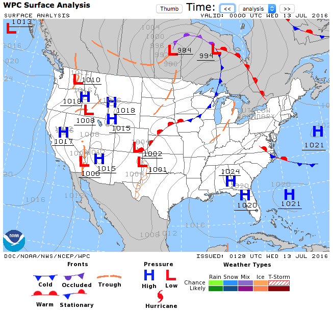
— Courtesy of NOAA Aviation Weather Center. In this example, a low (L) in Ontario has warm, cold, and occluded fronts attached. A stationary front crosses the east coast of the USA and another is in Newfoundland-Labrador. A dryline extends through western Texas from a low (L) on the Texas - New Mexico border.
Key words: front, cold front, warm front, stationary front, dry line, frontolysis, frontogenesis, squall line, cumuliform clouds, stratiform clouds, occluded fronts, cold occlusions, warm occlusions
Extra info for experts; not needed for this course.
- FAA AC 00-6A Aviation Weather, Chapter 8 on fronts.
- NOAA Aviation Weather Center (AWC) weather maps and forecasts
- NavCanada/ECCC Surface Weather Maps
- TC AIM. Scroll down this web page to find and download the pdf file for the "MET - Meteorology" chapter. Open the pdf and go to Section 10.0 on Surface Weather Maps.
Image credits. All the photos were taken by Roland Stull, and the drawings were made by Roland Stull, and all are copyright by him and used with his permission. The exception are the color frontal cross sections, courtesy of the US FAA.