ATSC 113 Weather for Sailing, Flying & Snow Sports
Upwelling
Learning Goals 10e: Describe the processes that drive coastal upwelling, and explain how upwelling and sea surface temperatures create fog.
We introduced the concept of upwelling back in section ‘9c Walker Cell and ENSO’, but here, we will look at it in closer detail and explore the relationship between upwelling and sea fog.
Upwelling is the rise of cold, nutrient-rich water from the deep ocean to the ocean surface. Similar to ocean currents, it is influenced by winds, the Coriolis effect, and Ekman transport (Learning Goal 9d). In the North Pacific, winds travelling along the west coast line of North America exerts drag on the water and causes the water to move. Then, the Coriolis effect and Ekman transport act together on the moving water to deflect the direction of water movement to be 90o to the right of the wind direction in the northern hemisphere, shown by the turquoise arrow in the figure below. (In the southern hemisphere the current is 90o to the left of the wind).
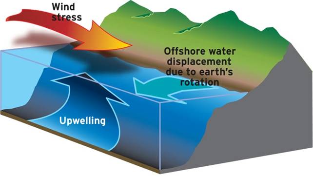
Source: NOAA Northwest Fisheries Science
Center.
https://www.nwfsc.noaa.gov/research/divisions/fe/estuarine/oeip/db-coastal-upwelling-index.cfm
For example, a wind from the north, blowing down the west coast of
Canada, will cause an ocean current from the east (which is 90 degrees
to the right of the wind direction). As the water moves toward
the west (turquoise arrow in the figure above), away from the continent land mass, the horizontally departing
water is replaced by water rising vertically toward the surface from
the deeper ocean. But deep-ocean water is colder. Thus,
colder water is pulled up from below (shown as the dark blue arrow in the figure above) to fill the space left by the
surface waters that had moved away. This means
that winds travelling from the north toward the south along the west coast of Canada will produce an
upwelling
of cold water. Similar upwelling occurs on the west coast of other continents.
Because upwelling brings cold water to the surface, it can affect
local weather and climate. In particular, cold surface water can
increase the likelihood
of fog. Fogs are discussed next, below. Many of these types
of fog also affect aviation, as is covered in Learning Goal 1h.
Sea Fog - formation
Fog arises when warm, humid air cools
beyond its dew point and condenses, forming droplets of water in the
air. Sea fog is a type of advection
fog, forming when warm, humid air
travels over a cooler surface, in this case water. Perhaps you can
start to see how upwelling could increase the occurrence of summer fog.
As the warm and humid summer air passes over the cold water recently
risen from the deep ocean, the air cools and condenses, forming fog over the
water.
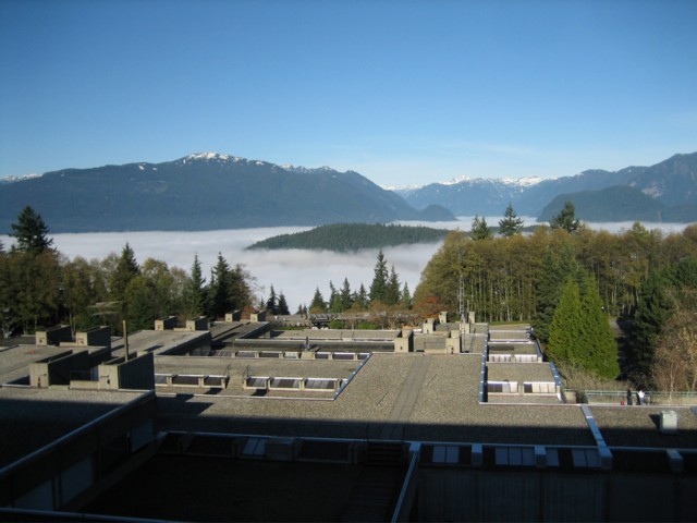
All fogs form as a relatively thin layer near the ground or sea
surface. In mountainous British Columbia, people on hilltops can often
look down onto the top of the fog that is filling the fjords and
inlets.
- Time lapse movie of fog over the waters surrounding Vancouver. https://www.youtube.com/watch?v=fOgF0KuPo3M
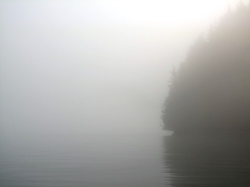
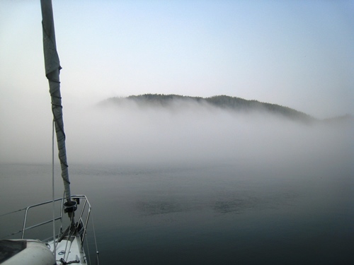
The following is a photo taken from SFU (a university in greater
Vancovuer) looking north over the fjords of Burrard Inlet and Indian
Arm. Those fjords are filled with fog. Clear skies above the fog
on this day.
Advection fog north of Simon Fraser University (SFU). Source: Bruce Thomson, used with permission.
There are 4 types of fog that you can encounter at sea. Advection fog is the main one; however, you could also see radiation fog, frontal fog, or arctic sea smoke.
Radiation
fog
develops over land, usually at night as the ground
cools beneath a stream of warm and humid air. The humid air cools and
condenses, forming fog. This type of fog would NOT form under windy
conditions, since the warmer and cooler airs would mix and prohibit a
given patch of air from cooling beyond its dewpoint. The fog usually
dissipates in the morning as the ground temperatures begin to
rise. Sometimes this fog will form in coastal valleys and the
cold foggy air will flow out of the valley onto the adjacent water body.
Frontal fog, also known as precipitation fog, forms at most types of fronts where warm air rises over colder air. As rain falls from the warm layer, it evaporates into the cool air before reaching the ground, causing the cool air to become saturated, creating fog. This type of fog appears more like low-lying cloud.
Arctic sea smoke is also known as steam fogin other parts of the world. It acts inversely to the other types of fog. When cold air blows over warm water, there is strong evaporation from the warm water into the air. So much water vapour evaporates from the sea surface to cause the cold air to become saturated. Also, as the bottom of the cold air is heated by the warm sea, this warm air rises into thermals. As a result, the foggy warm air rises in minature thermals. Arctic sea smoke is fleeting -- it disappears when the bottom hundred meters of air has been warmed by the warm ocean. This fog resembles wisps of smoke, rather than banks of fog, and is not considered a hazard to navigation.
Photos of these different types of fog were given in Flying-weather Learning Goal 1h.
When people refer to sea fog, they are usually referring to advection fog, which can pose a serious hazard to navigation. It can occur day or night all throughout the year, although is enhanced by coastal upwelling. As we mentioned in unit 9c, La Niña increases the amount of coastal upwelling and so can also contribute to greater periods of fog along the coast.
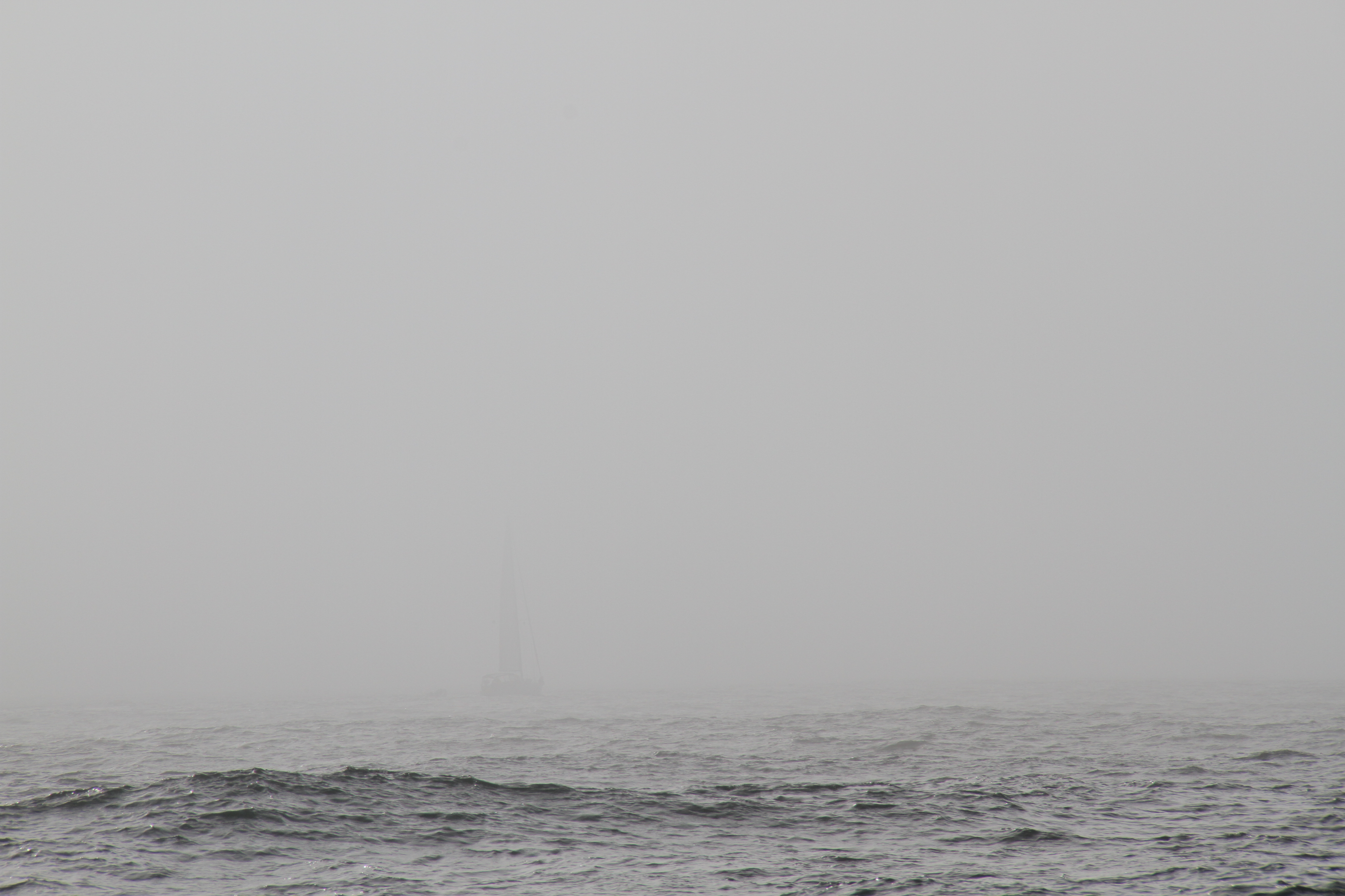
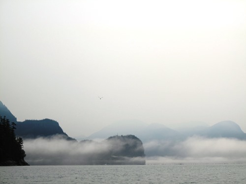
Caption: Can you see the other boat through the fog?
Source: ?? (UBC student).
Fog - dissipation
Several factors can dissipate fog (make the fog lessen or
disappear):- In daytime, sunlight can warm the air and gradually evaporate fog.
- In summer, the sun is higher in the sky than during winter, helping to dissipate fog faster in summer daytime.
- Faster or increasing winds can mix the fog with dryer air, allowing the fog to evaporate.
- Light winds can blow the fog away, or can blow fog toward
you.
- Human activities can warm the air to evaporate or mix-out
the
fog. For examples: turbulent mixing of the air under helicopters;
heat from cities and roads; heat added from fires or from jet engine
exhaust.
- It can become less dense, so you have greater
visibility. Eventually, the fog disappears completely, leaving
hazy air.
- It can lift off of the water. It becomes a low
cloud instead, with clear air underneath the cloud base.
Navigation in Fog
Understanding when and where fog is likely to develop can help you to avoid or navigate around it when on the water. Certain measures can be taken to navigate safely through the fog such as:
- Mount a radar reflector on your boat so that other boats with radar (e.g. freighters, cruise ships, etc) can see you on their radar screens
- Use a GPS to monitor your location (mark your known location as you enter the fog)
- Use an air horn to announce your location to others
- Communicate with others via VHF radio
- Move slowly
- Be prepared for rapid changes in position to avoid obstacles and other vessels
- Use radar if it is available to you
- Get rid of any background noise so you can listen for noises around you
In some regions along the BC coast, August is more commonly known as ‘Fogust’ due to the almost constant presence of sea fog in the mornings.
Additional Resources: (non-required material)
Chapter 5. Upwelling: Bringing Cold Water to the Surface: http://waves-vagues.dfo-mpo.gc.ca/Library/487.pdf
How to Sail in Fog: http://www.cruisingworld.com/how/how-sail-fog
Keywords: upwelling, Coriolis effect, Ekman transport, fog, sea fog, advection fog, radiation fog, Arctic sea smoke, steam fog, precipitation or frontal fog, La Niña
Image credits: Photos by Samantha James, unless otherwise given near the images.