ATSC 113 Weather for Sailing, Flying & Snow Sports
6 - Snow Sports: Winter Mountain Weather
Learning Goal 6d: Identify conditions that favour valley cloud/fog formation and dissipation
This learning goal helps tie together Learning Goals 6a, 6b, and 6c (cold air pooling, diurnal slope flows, and inversions).
Valley cloud and fog formation
During storms there are usually clouds at many altitudes (valley, mid-mountain, mountaintop, and higher). However, here we'll be talking about clouds that form under high pressure or fair weather conditions. Valley clouds form when you have moisture condensing in the air within the valley, but above the valley floor. Valley fog , by contrast, forms at the bottom of the valley. This is usually radiation fog (Learning Goal 1h). However, if you happen to be on a mountainside at valley-cloud level (i.e. within the valley cloud), the valley cloud will appear as fog to you (Fig. 6d.1). Essentially, fog is a cloud that is touching the ground!
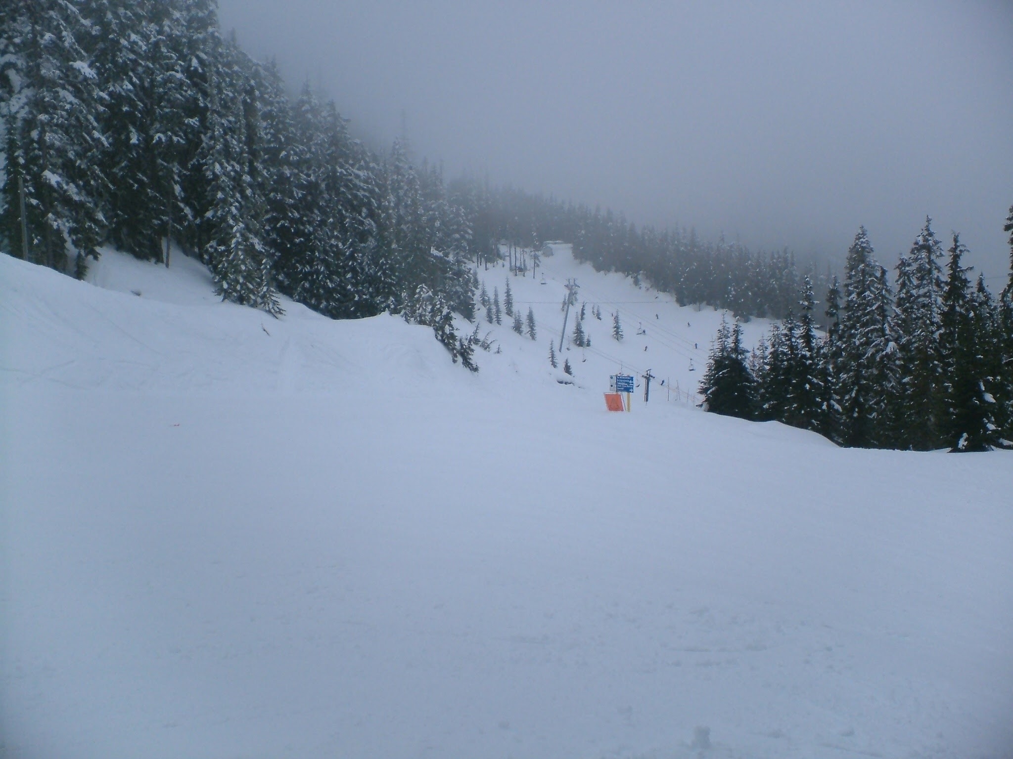
Fig. 6d.1 This is what it looks when you are inside a valley cloud. Photo taken on Whistler Mountain, BC. (Credit: Howard)
Subsidence due to high pressure can create an inversion (Learning Goal 6c) that is often strengthened by radiative cooling, particularly in the mountains by the snow on the ground. It can also be strengthened by cold-air pooling (Learning Goal 6a) as a result of nighttime katabatic winds, or downslope flow (Learning Goal 6b).
In the mountains, this inversion can trap air within valleys. This trapped air may contain moisture from a recent storm. If there is snow on the ground, or the ground is wet from recent rain, some moisture will evaporate into the valley air each day. Rivers and creeks can also be sources of moisture. Thus, if an inversion is present, moisture will continue to build within the trapped air for as long as the inversion is there, meaning that it is possible for the valley cloud or fog to persist for days or even weeks. Valley cloud and fog are very common in the mountain valleys of Interior BC in the winter months.
Check out the following links showing examples of valley fog:
- Fraser Valley fog and inversion layer from Seymour Mountain on the North Shore
- Video of fog over Vancouver from the North Shore Mountains
- Video of fog in a river valley in western Australia
Valley cloud and fog dissipation
After sunrise, some sunlight penetrates the cloud and fog to reach the ground. This heats the ground and adjacent air, ultimately making the fog layer unstable (warm air underneath cooler air). The warm air starts rising and the cold, more dense air from above sinks down, creating convective overturning, i.e. mixing.
The dissipation begins from the bottom-up. The lowest layers of the fog or cloud mix, evaporate, and dissipate first. From a skier's perspective at low elevations, the fog or cloud appears to "lift". Sometimes the heating is great enough that the fog/cloud layer completely dissipates by mid morning or afternoon. Other times, when the inversion is very strong, the fog does not completely "lift". As soon as the sun sets, the ground begins to cool and the fog forms next to the surface again. This pattern can continue for days or even weeks in winter if a persistent high pressure system is present.
Marine clouds and fog
When a high pressure system is situated just off the BC coast, e.g. to the west, we sometimes see marine clouds and fog form and move in from the ocean. These clouds and fog are also vertically trapped by a stable layer, and are some combination of advection fog and radiation fog (Learning Goal 1h). In this scenario, the low elevations and valleys near the coast become filled with fog.
The North Shore Mountains may see cloudy or foggy weather; however, sometimes they are above the clouds and fog, which can make for beautiful undercast conditions. It's more common to be able to get above the clouds on the taller volcanic peaks like Mount Baker and Mount Rainier, in Washington, USA.
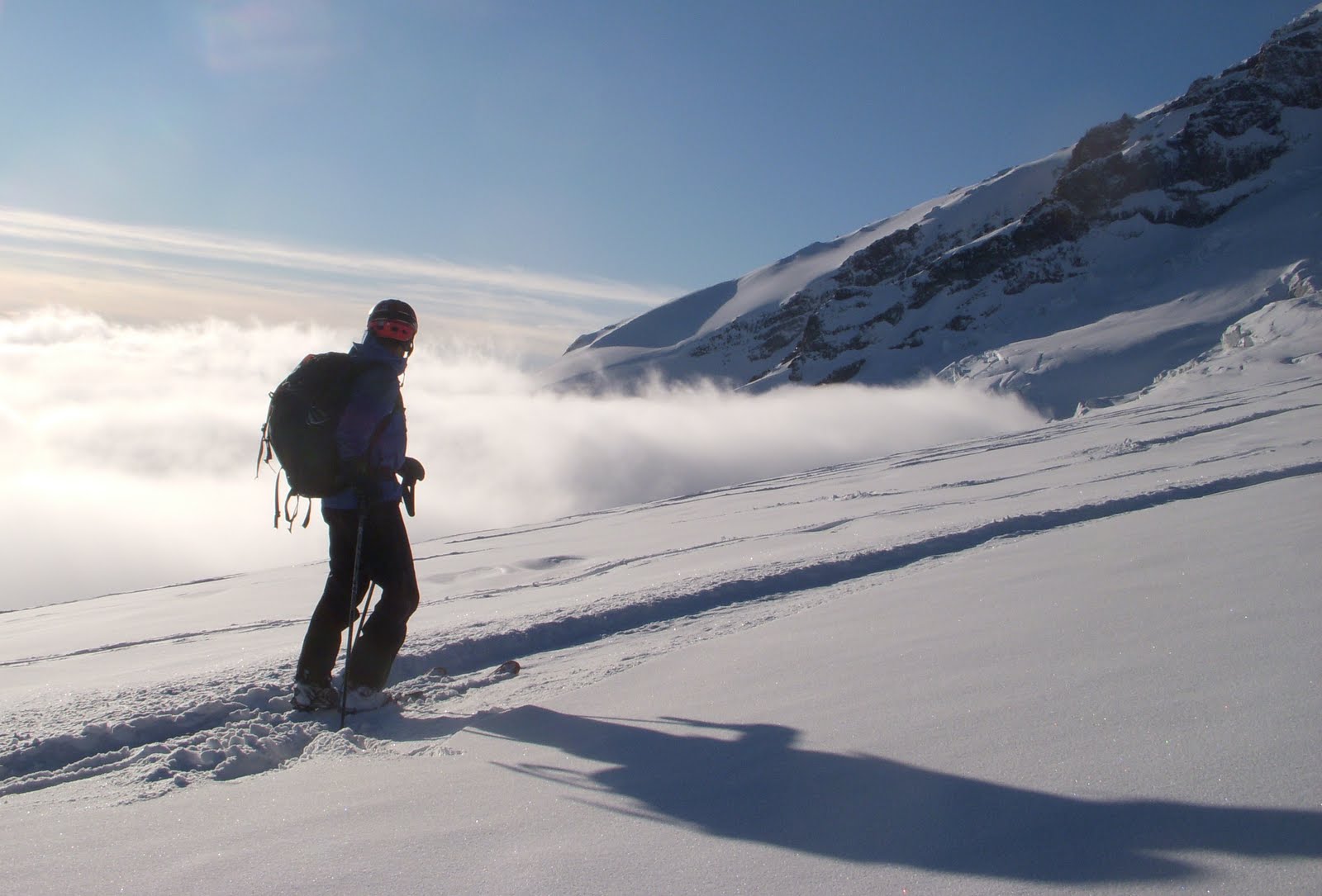
Fig. 6d.2 - A skier enjoys the view above an undercast marine layer on Mount Rainier, WA, USA. (Credit: West).
Sometimes the marine stratus clouds push up the Cheakamus Valley to Whistler, where you also may be able to get above the clouds, due to Whistler Mountain's relatively high elevation.
Freezing fog
When valley fog forms and temperatures are below freezing, freezing fog occurs. As discussed in Flying Learning Goals 1h and 3g, water droplets can exist in liquid form at below-freezing temperatures. These are called supercooled droplets, and they freeze into solid ice instantly when they come in contact with any surface that's below freezing. This means they can freeze to your equipment, clothes, or worse, your hair (including facial hair!). Rime ice is the result (Fig. 6d.3).
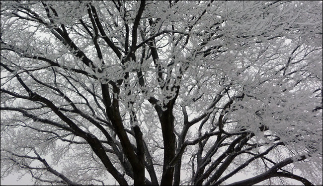
Fig. 6d.3 - Rime ice on a tree in freezing fog. (Credit: NOAA)
What hazards do valley cloud and fog present to skiers?
The main hazard resulting from valley cloud and fog is limited visibility. In the resort, reduced visibility makes skiing more hazardous. Often it's difficult to see the snow surface, so you have to "ski by feel". It's also easier to get lost or disoriented on the mountain when you can't see your surroundings. Groups may become separated, but usually your individual safety is not compromised since you are in a patrolled and bounded area (it can just be a bit scary if you don't know the mountain!).
In the backcountry becoming lost or separated presents a much greater hazard. This is why planning ahead of time, and having good navigation tools and abilities, are essential. If a lost member becomes injured, the difficulties are compounded. If you're not confident in your ability to ski or traverse to a non-foggy or non-cloudy area, it's often best to stay put and wait for the weather to improve.
Freezing fog doesn't present too many additional hazards. Rime ice quite easily brushes off of your shell pants and jacket. However, it's a good bet that the rime ice will melt at some point, leaving you cold and wet. It is smart to wear a waterproof shell, and a hood, helmet, or thick toque (thinner toques will also become cold and wet).
Keywords: valley clouds, valley fog, radiation fog,
inversion, cold air pooling, katabatic wind, downslope flow, marine
cloud and fog, advection fog, radiation fog, freezing fog, supercooled
droplets, rime ice, dissipate, lift, unstable
Figure Credits: Howard: Rosie Howard, West: Greg West, Stull: Roland Stull