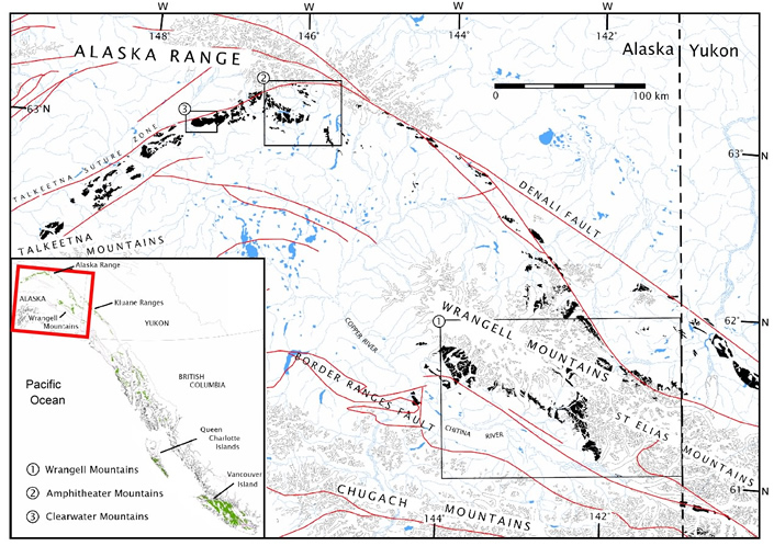
Simplified map of south-central Alaska showing the distribution of the Nikolai Formation (black), derived from the GIS-based digital map compilations of Wilson et al. (1998; 2005) and Schmidt (pers. comm., 2006). The three main areas that were studied are outlined with boxes and indicated in the legend. The inset shows the extent of the Wrangellia flood basalts (green) in Alaska, Yukon, and British Columbia, with a red box indicating the map location. The red lines are faults and faint grey lines are glaciers. Blue areas are lakes and rivers. Numbered boxes outline areas of field study in the:
1) Wrangell Mountains; 1) Amphitheater Mountains; and 3) Clearwater Mountains.