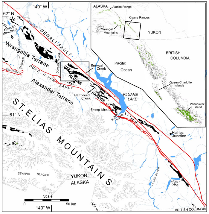
Simplified map of southwest Yukon showing the distribution of the Nikolai Formation (black; after Israel, 2004; Israel and Van Zeyl, 2004; Israel et al., 2005). The main area of field study in the Kluane Ranges is outlined with a rectangular box. Detailed faint lines in the St. Elias Mountains are glaciers and bold NW-SE-trending lines are parts of the Denali and Duke River Faults. Blue areas are lakes and rivers. The inset shows the extent of the Wrangellia flood basalts in British Columbia, Yukon, and Alaska, and a box shows the area of the map of southwest Yukon.