UBC ATSC 413 - Forest-fire Weather & Climate

Case: High Level, AB

A forensic weather analysis for a large, fast-growing fire over flat terrain.

Under construction.


Overview

Brief Chronology:
  • The fire starting on 12 May 2019 due to a lightning strike.
  • Fire was classified as “being held” before strong SE winds brought it out of control on 17 May.
  • Warm and dry weather through the end of May allowed the fire to continue to grow.
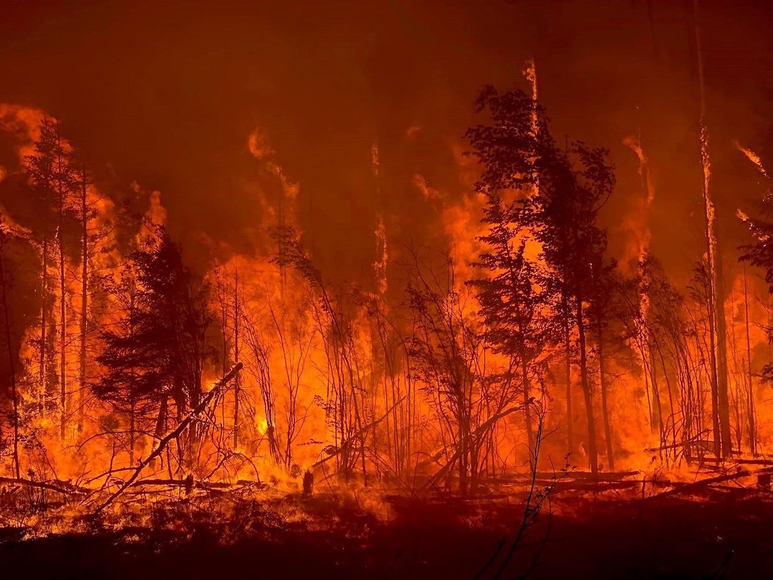
  • Fire was SW of of the town of High Level. Winds were from the east, keeping flames away from town (see photo).
  • On 23 Aug, Alberta Wildfire declared the fire to be under control.
  • On 22 Oct, the fire was finally extinguished.
Fire Facts:
  • Fire ID: HWF042.
  • Official Name: "Chuckegg Creek fire"
  • Total burned area: 350,135 ha
  • 98 days out of control
  • Required 8 shifts of Incident Management Teams (IMTs)
    +1 out-of-province IMT shift.
  • 5,333 personnel fighting this fire
  • Evacuation Orders were issued by Mackenzie County, the Town of High Level and the Dene Tha’ First Nation, displacing over 3,000 residents from their homes.

News Stories, including Photos and Movies

Timeline of Fire and Weather Evolution

Maps and Data on Weather and Fire Conditions that You Can Access for this Event

  1. Geography (Google Maps and Alberta topo map )
  2. Antecedent conditions: Global Wildfire Info System: GWIS (turn on the Fire Danger Forecast, and select the date) .
  3. Surface weather map from the NOAA Weather Prediction Center (WPC): Surface weather map (use the Calendar button to select the date, and then zoom to your region of interest). Also see an explanation of map symbols from the NOAA Jetstream tutorial site.
  4. Polar-orbiting satellite views of thermal anomalies (i.e., wildfire hot spots) via NASA's Worldview of satellite-observed hot spots, (select the date at bottom left, turn on place labels and boarders/coastlines, select Terra and Aqua/ MODIS orbital tracks, and turn on Fires and Thermal Anomalies.
  5. Worldview satellite imagery: https://go.nasa.gov/3L5Blr5
  6. To see Synoptic Weather Maps for this case, use the Forecast Tools link at the top of this web page. Click on the High-Level fire button, and use links in the left frame to select the weather maps you want to view. Use the arrow keys on your computer to step forward and backward in time.


Image Credits:
• Chronology photo: An aerial view of the firing operation on the Chuckegg Creek Fire southwest of High Level, Alberta. Source: https://wildfiretoday.com/tag/chuckegg-creek-fire/  
• Facts photo: https://highlevel.ca/370/Together-We-Stand
• xxx
• xxx