ATSC 113 Weather for Sailing, Flying & Snow Sports
Ceiling
Learning Goal 1d. Define the cloud ceiling, estimate its altitude, and relate it to cloud coverage amounts.
Pilots flying according to visual flight rules (VFR, see Learning Goal 1g) need to see where they are going. But in clouds, you can't see anything — so VFR pilots need to stay out of clouds. If a layer of clouds covers more than half the sky, then these clouds act like a lid or ceiling for VFR aviation, and constrains VFR flights to fly in the clear air below it (with some exceptions).
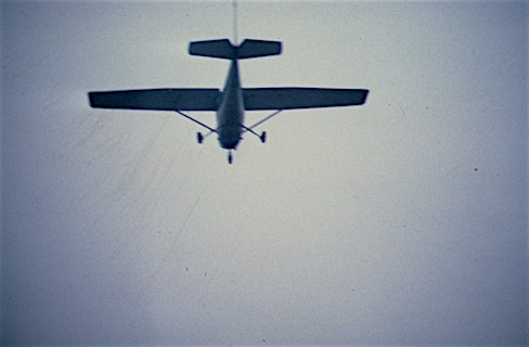
Flying below overcast clouds.
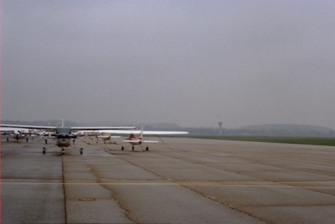
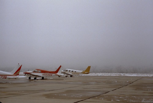
Don't fly if the cloud ceilling is too low. Leave your aircraft parked at the airport.
According to the International Civil Aviation Organization (ICAO), ceiling is the height above ground level (AGL) of the lowest cloud base (bottom of the cloud) that is below 20,000 ft (6,000 m) that is covering MORE than half the sky (i.e. cloud coverage amount is 5/8 or greater; namely, is either "broken" or "overcast" —see Learning Goal 1c). Ceilings are reported as a height, e.g. the ceiling is 500 feet above ground level.
In cases where there are such poor visibilities at ground level that a ground-based weather observer cannot see whether there are any clouds or not, then ceiling is reported as the vertical visibility (see Learning Goal 1e) within that surface-based poor-visibility layer. Examples would be in fog, or in forest-fire smoke, or in a dust storm.
Even pilots flying under instrument flight rules (IFR, see Learning Goal 1g) are concerned with ceilings, in order to be able to land at airports. The reason is that most aircraft and airports are not equiped with the very expensive equipment that allows aircraft to completely land themselves using the autopilot (known as a Category IIIc approach). Instead, the IFR pilot that is descending through a cloud layer needs to pop out below the cloud base at a high enough altitude to allow sufficient time to look around, find the appropriate runway at the airport, align the aircraft with the runway, and land safely.
Ceilings are measured with:
- Traditional ceilometers — Use a searchlight (ceiling
projector) at an angle relative to vertical to shine on the cloud
base. Change the angle until the illuminated spot on the cloud is
directly above a detector that is a known distance from the
spotlight. Then use trigonometry to calculate cloud-base height.
- Laser ceilometers — Send up a burst of light, and measure how long it takes the light from cloud base to reflect back.
- Ceiling balloons — Watch a red helium-filled latex balloon as it rises, record the balloon flight time until it disappears into the cloud, and then calculate the ceiling altitude based on typical rise rates of those balloons.
- Pilot reports — Ascending planes after take-off or descending planes approaching to land can report their altitude when they passed through cloud base.
- Weather-observer estimates — These are the worst estimates, because it is difficult to judge distance by eye, UNLESS the estimates are from tall towers or mountain tops that stick up into the clouds.
Estimation of cloud-base height |
Photo example |
|
Somewhat difficult to estimate the actual cloud-base height. You know that the ceiling is not lower than the mountain top, but you don't know how high the ceiling is above the mountain top. But VFR pilots flying under the clouds, or IRF pilots descending through the clouds, can make a better estimate. They can then report this ceiling estimate to flight information specialists on the ground, to relay to other pilots in the area. |
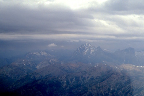 |
| Easy, for clouds that touch the top of high mountains of known height. | 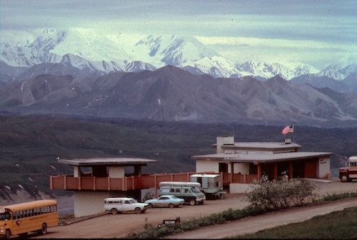 |
| Easy, for clouds that touch a medium-height mountain of known height. | 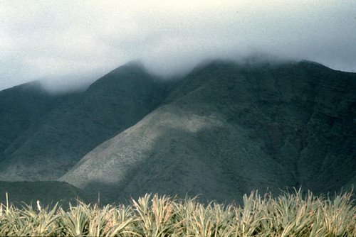 |
|
Easy, when clouds are so low that they touch very low hills. But unfortunately this leaves almost no room for aircraft to fly visually (VFR) under the clouds.
Image courtesy of the US Southern Region Headquarters National Weather Service, of the National Oceanic and Atmospheric Administration (SRH-NOAA). |
 |
|
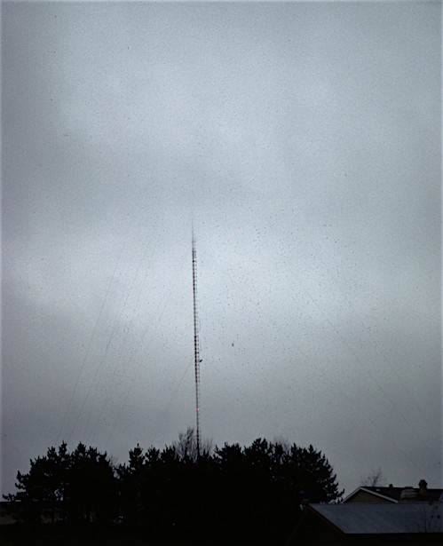
Easy, for clouds that touch a tall tower of known height. (Another hazard for pilots flying under lower clouds is accidentally hitting the tower, or accidentally hitting the guy wires that prevent the tower from falling over in high winds. Can you see the guy wires in this photo? The guy wires are often very hard to see in flight, particularly if visibility is poor under the clouds.) |
 |
|
Easy, when clouds are so low that they touch the tree tops. Unfortunately... too low to fly VFR. Postpone your trip if possible, cancel your trip if needed, or find some other way to get to your destination (commercial flight, bus, train, etc.) |
 |
|
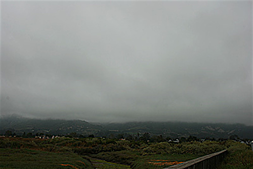
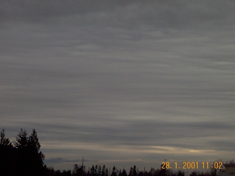
Caution. In this photo taken from UBC, you can see the tops of mountains on Vancouver Island off in the distance. (The dark grey item very low on the horizon, almost hidden behind the trees near the left side of the photo.) But beware that cloud-bases are often tilted over large distances. Thus, the height of the cloud base over UBC might not be the same as the cloud base over the mountains of Vancouver Island. (view is looking southwest from UBC) |
 |
| Difficult. Interesting-looking stratiform clouds, but no way to estimate the height of cloud base by eye. |  |
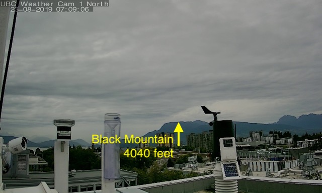
Here is another sequence of lowering ceilings (taken on different days), using photos and movies from our UBC rooftop weather camera, looking north towards the North Shore mountains. The first image below shows a layer of stratus clouds, but it is not touching the top of Black Mountain. Although we visually don't know the ceiling height, we DO know that it is not below the 4040 foot mountain top.
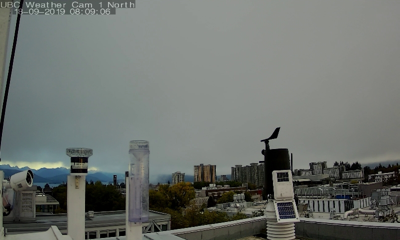
The next image shows lower clouds, well below mountain top, but above the tops of some of the tall buildings on the UBC campus. You should not try to fly under these clouds VFR, because you would likely hit a building.
The last picture shows a very very low ceiling, well below the tops of the buildings.
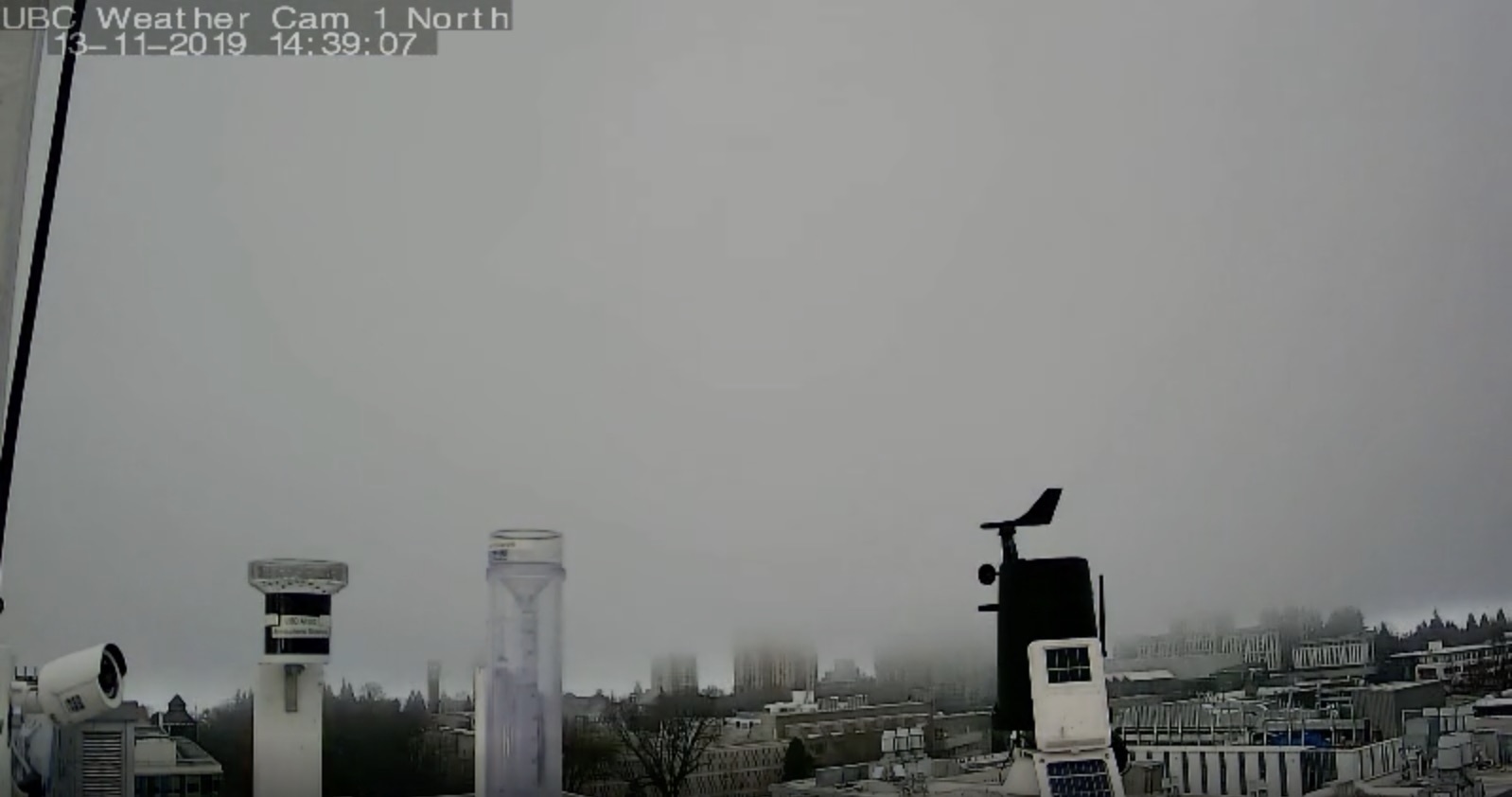
Here are two movies. The first shows ceilings lowing from above the top of Black Mountain to below the top. The second shows extremely low ceilings. Both are from the north-looking UBC rooftop weather camera.
.
Safety Recommendation for Pilots
If you don't have an IFR rating, or don't have recent experience flying IFR, or are in an aircraft without the instruments required for IFR flight, then you should NOT fly into clouds or into regions of low visibility.
For passengers on all regional and large airlines — don't worry. The pilots and the aircraft are capable of IFR instrument flight.
Because ceilings and visibility are so closely related, and because they are the primary considerations for whether a flight can be VFR or must be IFR, they are sometimes reported together. An example:
CAVOK = Ceiling and Visibility are OK (i.e. good for VFR flight)
Keywords: above ground level (AGL), broken, CAVOK, ceiling, instrument flight rules (IFR), overcast, vertical visibility, visual flight rules (VFR)
Extra info for Experts; Not Needed for this Course.
- USA FAA AIM, Section 7-1-16: Reporting of Cloud Heights (i.e. ceilings)
- Environment Canada: Manual of Observations (MANOBS), Chapter 1, section 1.7: Ceiling
- For cumuliform clouds, cloud base is called the Lifting Condensation Level (LCL). Here is how you can calculate the height of the LCL above the airport, if you know the temperature and humidity from the airport weather station.
- Canadian TC AIM sections MET 4.09-4.11, 8.3, on ceiling and visibility
- World Meteorological Organization (WMO) Manual of Observations, Chapter 15 Clouds
- US Federal Meteorological Handbook No. 1, Chapter 9: Sky Condition
Image credits. All figures by Roland Stull, except where otherwise noted.